Catalogue des publications
Les achats en ligne sont suspendus, sauf pour les fichiers. Veuillez noter que l'Ifao sera fermé du 31 juillet au 31 août inclus - Please note that the Ifao will be closed from 31st of July to 31st of August - برجاء العلم أن المعهد سيكون مغلقا من 31 يوليو إلى 31 أغسطس Veuillez contactez : ventes@ifao.egnet.net. J'ai un code promotionnel.
On line orders are suspended, except for files. Veuillez noter que l'Ifao sera fermé du 31 juillet au 31 août inclus - Please note that the Ifao will be closed from 31st of July to 31st of August - برجاء العلم أن المعهد سيكون مغلقا من 31 يوليو إلى 31 أغسطس Please contact : ventes@ifao.egnet.net. I have a promotional code.
Fouilles de l’Institut français d’archéologie orientale (FIFAO)
La collection Fouilles de l’Institut français d’archéologie orientale (FIFAO) se consacre à la publication scientifique des travaux archéologiques conduits sur l’ensemble des chantiers de l’Ifao. Elle est constituée de plusieurs séries : Balat, Tebtynis, Karnak-nord, Archéologie islamique, etc.
ISBN 9782724711271
2026 IFAO
Collection: FIFAO 98
Langue(s): français
1 vol. 684 p.
149 € (7842 EGP)
Emmanuel Botte (éd.), Hélène Cuvigny (éd.), Michel Reddé (éd.)
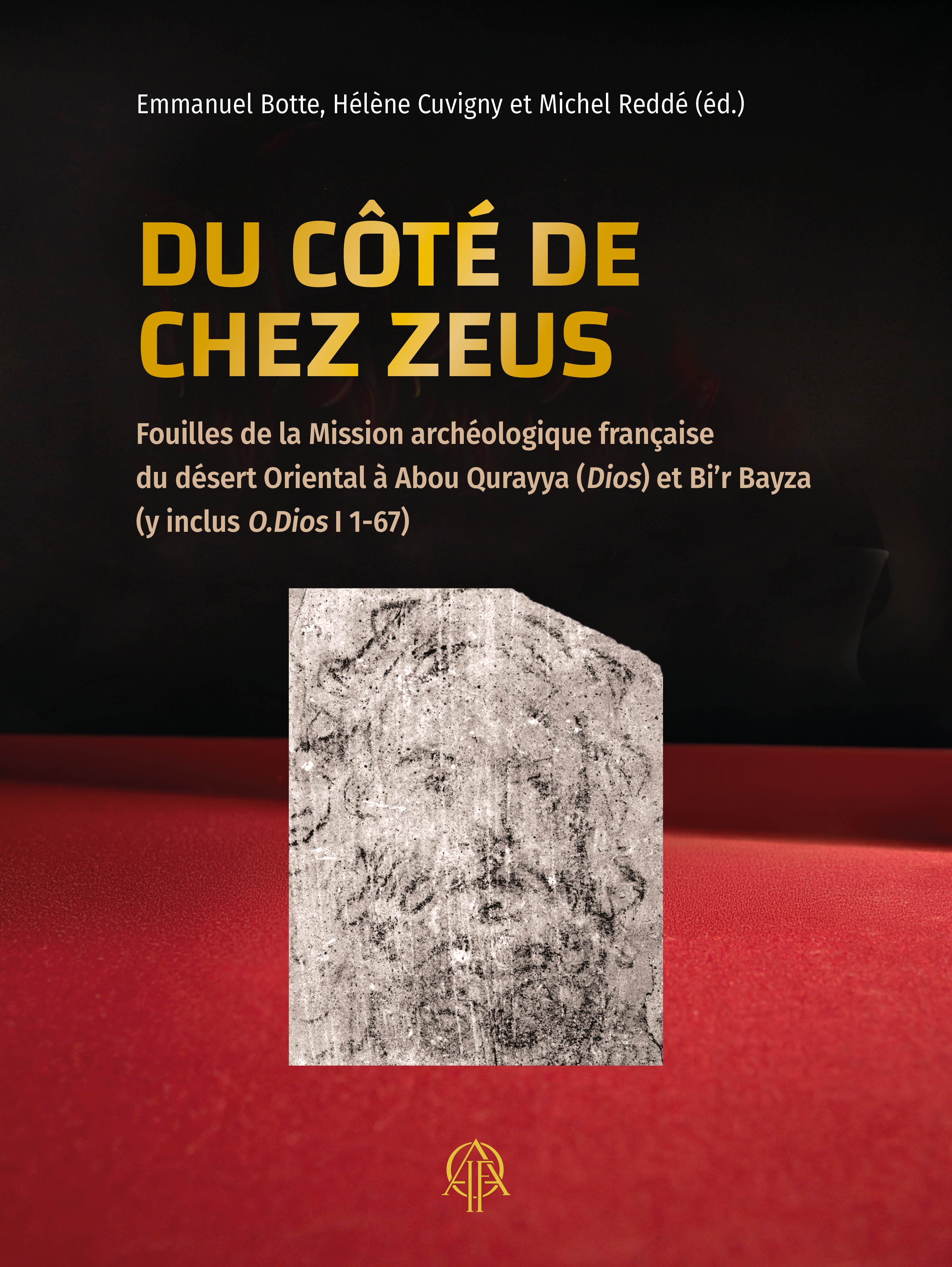
Du côté de chez Zeus
Fouilles de la Mission archéologique française du désert Oriental à Abû Qurayya (Dios) et Bi’r Bayza (y inclus O.Dios I 1-67)
« Du côté de chez Zeus » traduit l’expression grecque par laquelle les ostraca du poste caravanier d’Abû Qurayya désignaient ce lieu, situé sur la piste antique qui reliait Koptos, sur le Nil, à Bérénice, sur la mer Rouge. Le fortin, construit en 117 de notre ère, avait succédé à un précédent (Bi’r Bayza), situé à quelques kilomètres de là, et dont le puits s'était tari. Ce livre, consacré à l’archéologie de ces deux sites, explorés de 2006 à 2009, s’inscrit dans la suite des publications précédentes sur la route de Myos Hormos, le praesidium de Didymoi ou encore les carrières d’Umm Balad. Il contient aussi l’édition d’un certain nombre d’ostraca jugés importants pour la compréhension de l’histoire de ces postes. Enfin, il livre pour la première fois une étude raisonnée de la céramique découverte dans ces différents fortins du désert Oriental.
"Du côté de chez Zeus" is the translation of the Greek expression used on the ostraca of Abu Qurayya's caravan station to designate this place, which is located on the ancient route linking Koptos, on the Nile, to Berenice, on the Red Sea. The fort, built in 117 AD, had succeeded an earlier one (Bi’r Bayza), located a few kilometres away, whose well had run dry. This book, devoted to the archaeology of these two sites explored between 2006 and 2009, continues the previous publications on the Myos Hormos road, the Didymoi praesidium and the Umm Balad quarries. It includes editions of a number of ostraca deemed important for understanding the history of these posts. It also provides, for the first time, a reasoned study of the ceramics found in these various forts in the Eastern desert.
"في ديار زيوس" هو ترجمة للتعبير اليوناني الوارد في الشقفات المكتشفة في موقع قوافل أبو قُرَيَّة. وكان يُطلق على هذا الموضع الواقع على الطريق القديم الرابط بين قِفط على نهر النيل وبرنيس على ساحل البحر الأحمر. شُيّد الحصن في هذا الموقع سنة ١١٧م، ليخلف حصنًا سابقًا في"بئر بايظة" كان يقع على بُعد بضعة كيلومترات، عندما أصبحت بئره غير صالحة للاستعمال بعد نضوب مياهها. يُخصَّص هذا الكتاب لدراسة البقايا الأثرية في هذين الموقعين اللذين خضعا لأعمال استكشاف خلال الفترة ما بين عاميّ ٢٠٠٦ و ٢٠٠٩. ويأتي هذا العمل في سياق استكمال لإصدارات سابقة متعلقة بالطريق المؤدي إلى ميوس هورموس، وحامية ديديموي، وكذلك المحاجر الرومانية في أم بلد. يتضمّن الكتاب أيضًا نشرًا لمجموعة مختارة من الشقفات، التي اعتُبرت ذات أهمية خاصة لفهم تاريخ هذه المحطات الصحراوية. ويُخْتَتَم العمل لأول مرة بتقديم دراسة تحليلية منهجية للخَزَف المكتشف في هذه الحصون المختلفة بالصحراء الشرقية.
- Emmanuel Botte (
 : 137387458)
Emmanuel Botte est chargé de recherches au CNRS et directeur adjoint du Centre Camille Jullian (UMR 7299). Archéologue, spécialiste de l’artisanat et du commerce à l’époque romaine, il a participé à plusieurs opérations en Méditerranée et il dirige depuis 2015 un programme de recherches sur la romanisation de la Dalmatie. - Hélène Cuvigny ( : 028856988)
Hélène Cuvigny est papyrologue. Ancienne élève de l’ENS Sèvres, agrégée de lettres classiques, ancien membre scientifique de l’Ifao et directrice de recherche émérite au CNRS, elle a dirigé de 1994 à 2013 le programme « Praesidia du désert Oriental ». - Michel Reddé ( : 028750349)
Michel Reddé est archéologue. Ancien élève de l’ENS Ulm, agrégé de lettres classiques, ancien membre de l’École française de Rome, directeur d’études émérite à l’École pratique des hautes études / Université Paris Sciences et Lettres, médaille d’argent du CNRS.
- Vous pouvez acquérir ce(s) fichier(s) PDF issu(s) de cet ouvrage en cliquant sur le nom du fichier puis 'Ajouter au panier'.
- You can buy theses PDF files extracted from this book by clicking on the file name then 'Add to cart'.
ISBN 9782724711288
2026 IFAO
Collection: FIFAO 99
Langue(s): anglais
1 vol. 344 p.
64 € (3368 EGP)
Colin Hope
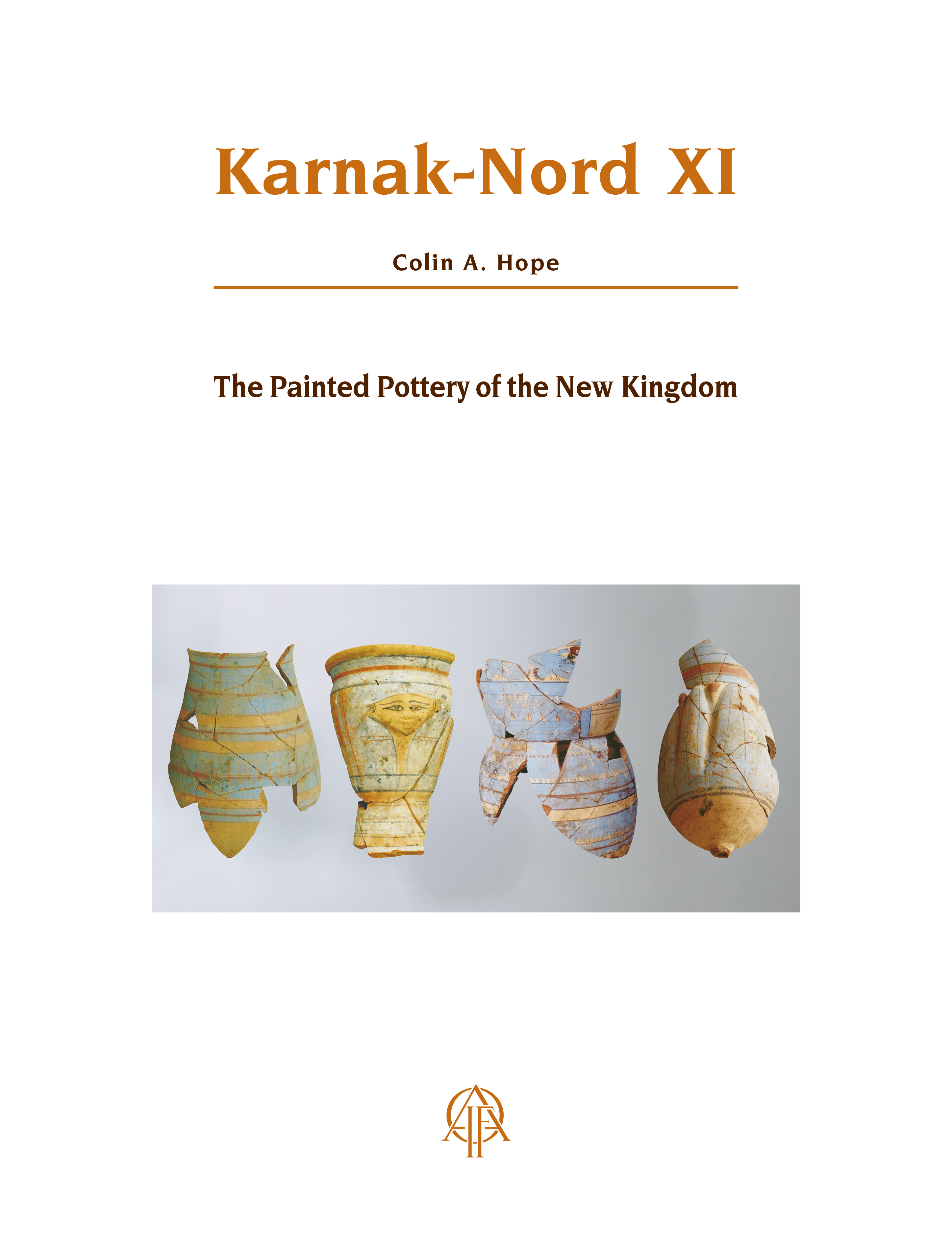
Karnak-Nord XI
The Painted Pottery of the New Kingdom
The volume publishes the painted pottery from the excavations at Karnak North by Jean and Helen Jacquet, and Philippe Brissaud. The material attests three categories: monochrome- and bichrome-painted, and blue-painted pottery, with the majority of the latter type. The forms occurring in each category are presented separately and the motifs employed upon each category are identified and presented in an extensive list. While the pottery derives from disturbed contexts, and the majority was dumped at the site and may have been moved several times, it is an important selection of material. This is especially the case with the blue-painted pottery. The collection enables a comparison of the categories to be made and their interconnections identified. The corpora of bichrome-painted pottery and blue-painted pottery are compared with those from elsewhere in Egypt and their evolution from the mid-18th to mid-20th Dynasties is analysed. The function of each category is reviewed and, in relation to the blue-painted pottery, the marks found upon certain forms are analysed to shed light upon this topic and its place/s of manufacture. Most of the blue-painted pottery is of the period covered by the reigns of Amenhotep III to Tutankhamun; its origin in the temples erected by Akhenaten at Karnak East is considered.
Ce volume est la publication de la céramique peinte provenant des fouilles de Karnak-Nord par Jean et Helen Jacquet, et Philippe Brissaud. Le matériel se divise en trois catégories : la céramique monochrome, la céramique bichrome et la céramique peinte en bleu, ce dernier type étant majoritaire. Les formes attestées dans chacune des catégories font l’objet d’une présentation individuelle, et les motifs employés dans le décor de chaque catégorie sont identifiés et présentés dans une liste exhaustive. Bien que la céramique provienne de contextes perturbés, que la majorité soit issue de dépotoirs et ait pu être déplacée à plusieurs reprises, il s’agit d’une importante sélection de mobilier. C’est particulièrement le cas pour ce qui concerne la céramique peinte en bleu. La collection permet en outre de comparer les catégories entre elles et de mettre en évidence leurs interconnexions. Les deux corpus de céramique peinte bichrome et de céramique peinte en bleu sont comparés à des corpus provenant d’autres régions d’Égypte, et une analyse de leur évolution entre le milieu de la XVIIIe et le milieu de la XXe dynastie est proposée. La fonction de chaque catégorie est examinée et, en ce qui concerne la céramique peinte en bleu, les marques mises en évidence sur certaines formes sont analysées, de manière à améliorer notre connaissance de cette pratique et de son ou ses lieux de fabrication. La plupart des céramiques peintes en bleu datent de la période comprise entre les règnes d’Amenhotep III et de Toutânkhamon et l’hypothèse de leur origine dans les temples érigés par Akhénaton à Karnak-Est est examinée.
ينشر هذا الكتاب أعمال الخَزَف الملون من حفائر موقع الكرنك الشمالي، التي أجراها ﭼﺎن وهيلين ﭼﺎكيه، وفيليب بريسو. وقد قُسِّمَت المواد إلى ثلاث فئات: الخَزَف أحادي اللون، الخَزَف ثنائي اللون، والخَزَف الملوَّن بالأزرق – وهو الفئة الغالبة عددًا. كما خُصِّص عرض وصفي تحليلي مستقل لكل نوع من الأشكال المثْبَتة ضمن هذه الفئات، وجرى توثيق الزخارف المستخدمة في تزيين كل فئة ضمن قائمة حصرية شاملة. ورغم أن هذا الخَزَف استُخرج من سياقات أثرية مضطربة، وأن غالبه يأتى من مكبات النفايات وربما نُقل عدة مرات، فإنه يُعدّ مجموعة مختارة وهامة من القطع الأثرية، وخصوصًا للخَزَف الملوَّن بالأزرق. بالإضافة إلى ذلك فإن هذه المجموعة تُتيح إمكانية إجراء مقارنة بين الفئات الثلاث، وإبراز العلاقات والتداخلات فيما بينها. كما يُقارن كل من الركامين ثنائي اللون وذو اللون الأزرق بمجموعات مماثلة في مناطق أخرى في مصر، وترصد دراسة تحليلية التغيّرات والتطورات التي طرأت على هذا الخَزَف ما بين منتصف الأسرة الثامنة عشرة ومنتصف الأسرة العشرين. وقد جرت مراجعة الوظيفة المفترضة لكل فئة، وبخاصة ما يتعلق بالخَزَف الأزرق؛ إذ خَضَعت العلامات المميَّزة المكتشفة على بعض القطع لتحليل دقيق يهدف إلى تعزيز فهمنا لهذه الممارسة ومواقع إنتاجها. يعود تاريخ معظم الخَزَف الملوَّن بالأزرق إلى الفترة الممتدة بين حكم أمنحتب الثالث وتوت عنخ آمون، وتتم دراسة فرضية أن أصله يعود إلى المعابد التي شيّدها أخناتون في موقع الكرنَك الشرقي.
- Colin Hope
Colin A. Hope is Adjunct Senior Research Fellow at Monash University. His current research focuses upon the archaeology of Egypt’s Western Desert, where he directs excavations at Ismant al-Kharab and Mut al-Kharab in Dakhla Oasis. He also has a specialisation in Egyptian ceramics, particularly of the New Kingdom.
- Vous pouvez acquérir ce(s) fichier(s) PDF issu(s) de cet ouvrage en cliquant sur le nom du fichier puis 'Ajouter au panier'.
- You can buy theses PDF files extracted from this book by clicking on the file name then 'Add to cart'.
Felix Relats Montserrat
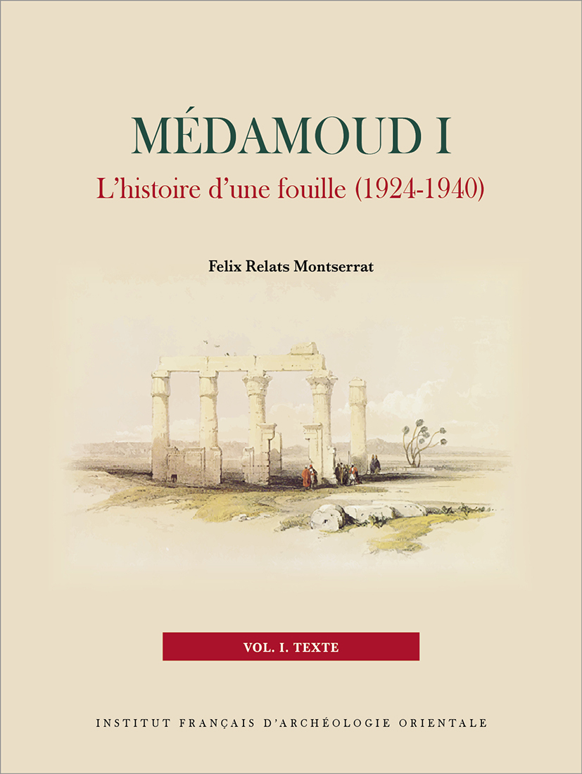
Médamoud I
L'histoire d'une fouille (1924-1940)
Les fouilles françaises de Médamoud se sont déroulées entre 1924 et 1939 sous la direction de F. Bisson de la Roque (1924-1932) et de Cl. Robichon (1933-1939). Elles mirent au jour de nombreux monuments s’échelonnant de la XIe dynastie jusqu’à l’époque byzantine. L’ensemble de cette documentation constitue un corpus riche mais hétérogène dont il a fallu restituer le contexte de découverte, d’autant que les fouilles ont été inégalement publiées. Dans cette optique, il s’est avéré nécessaire, en premier lieu, d’inventorier les vestiges afin de préciser leur datation, leur interprétation et la manière dont ils furent dégagés au début du XXe siècle. Or, l’analyse de l’exploration d’un site, si elle documente les découvertes archéologiques réalisées, livre tout autant d’informations sur le contexte de l’époque où elles ont eu lieu, à la fois sur le plan intellectuel, technique et politique. De là découle le second objectif de l’ouvrage, Médamoud offrant un cas d’étude pour comprendre la manière dont était organisée une mission archéologique, aussi bien du point de vue pratique, que sous l’angle administratif, au début du XXe siècle. Le présent ouvrage est donc organisé en deux parties, présentant d’abord un historique de l’exploration du site, puis un inventaire des structures découvertes.
The French excavations at Medamud took place between 1924 and 1939 under the direction of F. Bisson de la Roque (1924-1932) and Cl. Robichon (1933-1939). They uncovered numerous monuments ranging in date from the 11th Dynasty to the Byzantine period. All of the documentation constitutes a rich but heterogeneous corpus. However, since the publication of the excavations was uneven, it has been necessary to recreate the process of discovery. In order to understand the context in which the architectural remains were found at the beginning of the 20th century, they were inventoried while verifying their dating and interpretation. Since the analysis of the exploration of a site that documents the archaeological discoveries also yields information about the intellectual, technical, and political context of the period in which it took place, this book also presents Medamud as a case study for understanding how an archaeological mission was organized, both practically and administratively, at the beginning of the 20th century. The present work is thus organized in two parts, first presenting a history of the exploration of the site, then an inventory of the structures discovered.
جرت الحفائر الفرنسيَّة في مدامود في الفترة من ١٩٢٤م وحتى ١٩٣٩م تحت إشراف F. Bisson de la Roque (١٩٢٤-١٩٣٢م) وCl. Robichon(١٩٣٣-١٩٣٩م) حيث تم اكتشاف العديدَ مِنَ الآثارِ التي تتراوح من عصر الأسرة الحادية عشرة إلى العصر البيزنطي. تُشكّل كل هذه المكتشفات مجموعةً ثرية، ولكن غير مُتجانسة، فكان لا بد من العودة إلى الظروف التي اكتشفت فيها، خاصة أن عمليات التّنقيب لم يتم نشرها بالتساوٍي. ومن هذا المنطلق، كان لا بد أوَّلًا من القيام بحصر الآثار لتحديد تأريخها وتفسيرها والطريقة التي تم استخراجها بها في بداية القرن العشرين. ومع ذلك، فإن تحليل استكشاف موقع ما، إذا كان يوثّق الاكتشافات الأثريَّة التي تمّت، يوفّر نفسَ القدرِ مِنَ المعلومات حول الفترة التي حدثت فيها، فكريًا وتقنيًا وسياسيًا. ومن هنا ينبع الهدف التالي لهذا الكتاب "مدامود" الذي يقدم نموذج دراسة لفهم كيفية تنظيم البعثة الأثريَّة، عمليًا وإداريًا، في بداية القرن العشرين. ولذلك، تمَّ تنظيم العمل الحالي في جزئين، يقدم الأوَّل منهما تاريخ استكشاف الموقع، ويقدم الثاني جرد للمباني المُكتشفة.
- Felix Relats Montserrat ( : 196934559)
Agrégé d’histoire, docteur en égyptologie de l’université de Paris-Sorbonne, membre scientifique de l’Institut Français d’Archéologie Orientale du Caire entre 2017 et 2021. Ses recherches portent sur les relations nouées entre le pouvoir royal et les temples, ainsi que sur l’insertion de ces derniers dans leur environnement urbain. Il s’intéresse également à l’artisanat égyptien et tout particulièrement à la production de céramiques. En parallèle, ses recherches doctorales l’ont amené à développer une réflexion sur l’histoire de l’égyptologie au début du XXe siècle. Il dirige la mission Ifao / Sorbonne de Médamoud avec le soutien de la commission des fouilles du MEAE (Louqsor).
- Vous pouvez acquérir ce(s) fichier(s) PDF issu(s) de cet ouvrage en cliquant sur le nom du fichier puis 'Ajouter au panier'.
- You can buy theses PDF files extracted from this book by clicking on the file name then 'Add to cart'.

ISBN 9782724710151
2024 IFAO
Collection: FIFAO 95
Langue(s): français
1 vol. 305 p.
50 € (2632 EGP)
Béatrix Midant-Reynes (éd.), Nathalie Buchez (éd.)
Tell el-Iswid – 2010-2018
Les occupations naqadiennes du secteur 4
Ce second volume des fouilles de Tell el-Iswid est consacré aux vestiges naqadiens du secteur 4. Il s’agit d’un bâti de briques crues, couvrant essentiellement la période Naqada IIIA-B. Trois phases de transformations majeures ont été décelées. La mieux représentée est la phase 2 dont le bâti a été plusieurs fois remanié. Une attention particulière a été accordée aux structures de combustion.
À ces transformations architecturales répondent des changements dans la culture matérielle (céramique, industrie lithique, petit mobilier) en lien avec les données relatives à l’économie de subsistance (faune et micro-restes végétaux).
La céramique, en particulier, a été étudiée selon des approches nouvelles, où les classifications sont fondées prioritairement sur les techniques de fabrication et la restitution des chaînes opératoires, ce qui permet de mieux appréhender les identités culturelles et de dépasser les visées essentiellement chronologiques des classifications morpho-stylistiques traditionnelles.
Les travaux ici présentés prennent place dans le renouvellement des données apportées par les fouilles du site voisin de Tell el-Farkha et par celles de Bouto dans le delta occidental. Ils contribuent à jeter, depuis le Delta, un nouvel éclairage sur les transformations socio-culturelles qui ont affecté l’ensemble de la Vallée du Nil dans le dernier tiers du IVe millénaire.
This second volume of the Tell el-Iswid excavations is devoted to the Naqada period remains in sector 4. It concerns a mud-brick building, dating essentially to the Naqada III A-B period. Three major phases of transformation were detected. The best represented is phase 2, which was reworked several times. Particular attention was paid to the structures which were burned.
These architectural transformations are mirrored by changes in material culture (ceramics, lithic industry, small finds) in connection with data relating to the subsistence economy (fauna and plant micro-remains).
Ceramics have been studied according to new approaches, in which classifications are based primarily on manufacturing techniques and the reconstruction of the « chaîne opératoire », which makes it possible to better understand cultural identities and to go beyond the essentially chronological aims of traditional morpho-stylistic classifications.
The work presented here is part of the review of data from excavations at the neighboring site of Tell el-Farkha and at Bouto in the western Delta. They contribute to shedding new light from the Delta on the socio-cultural transformations that affected the whole Nile valley in the last third of the 4th millennium BC.
يخصص هذا المجلد الثاني من حفائر تل الأسود للبقايا الأثرية لموقع نّقادة في القطاع رقم ٤. ويتعلق بمبنى من الطوب اللبن، يعود تاريخه بشكلٍ أساسي إلى فترة نقادة الثالثة «أ-ب» (IIIA-B). وقد تمَّ الكشف عن ثلاث مراحل رئيسية من التّحوّل. أفضل مرحلة مُمثَّلة هي المرحلة رقم ٢، والتي تمَّ إعادة عملها عِدَّة مرّات. وقد وجه اهتمام خاص بالمباني الخاصة بالحرق.
تتواءم هذه التّحوّلات المعماريَّة مع تّغيُّرات في الثّقافة الماديّة (الفخار، الصِّناعة الحجريَّة، اللُقى الصّغيرة) فيما يتعلق بالبيانات المتعلقة بـ «اقتصاد الكفاف» (البقايا الدّقيقة للحيوانات والنباتات).
وقد تمَّت دراسة الفخار، على وجه الخصوص، وفقًا لمُقاربات جديدة، حيث تعتمد التصنيفات المستخدمة في المقامِ الأوَّل على تقنيات التّصنيع واستعادة سلسلة التّشغيل، مِمَّا يتيح فهم الهويّات الثّقافيَّة بشكلٍ أفضل وتجاوز الأهداف التّأريخية الأساسية للتصنيفات المورفولوجيّة الأسلوبيّة التقليديّة.
يقع العمل المعروض هنا ضمن تحديث البيانات التي أتاحتها أعمال التنقيب في موقع «تل الفرخة» المجاور لموقع تل الأسود، وتلك الموجودة في بوتو في الدلتا الغربيَّة. وتسهم في تسليط ضوءٍ جديد على التَّحوّلات الاجتماعيَّة والثّقافيَّة في الدلتا والتي أثّرت على وادي النيل كله في الثُّلث الأخير من الألفيّة الرابعة قبل الميلاد.
- Béatrix Midant-Reynes ( : 030156963)
Beatrix Midant-Reynes est spécialiste dans l'étude de la préhistoire égyptienne. Elle a dirigé plusieurs chantiers de fouilles en Égypte, tous centrés sur la période prédynastique : Adaïma, en Haute Égypte, Kom el-Khilgan et Tell el-Iswid, dans le Delta oriental. De 2000 à 2015, elle a codirigé le volet préhistoire du programme de prospection du bassin sud de Douch (oasis de Kharga). De 2010 à 2015, elle a été directrice de l'Institut français d'archéologie orientale. Elle est actuellement directrice de recherche émérite au CNRS. La diffusion des connaissances à un plus large public fait partie de ses préoccupations, elle a ainsi publié "Prehistory of Egypt, From the First Egyptians to the First Pharaohs" en 2000 et "Aux origines de l'Égypte. Du Néolithique à l'émergence de l'État" en 2003. - Nathalie Buchez ( : 066514290)
Nathalie Buchez est responsable de recherche archéologique à l’Institut national de recherche en archéologie préventive (Inrap) où elle est plus particulièrement en charge d’opérations de terrain, d’études céramiques et de coordination de projets concernant les âges du Bronze et du premier âge du Fer dans le nord de la France. Docteure en archéologie de l’EHESS, rattachée à l’UMR 5608-TRACES de Toulouse, elle poursuit des recherches sur l’Egypte prédynastique depuis 1989. En 2015, elle a succédé à Béatrix Midant-Reynes comme responsable de la fouille de Tell el-Iswid (Delta oriental) pour l’Ifao et le ministère de l’Europe et des Affaires étrangères.
- Vous pouvez acquérir ce(s) fichier(s) PDF issu(s) de cet ouvrage en cliquant sur le nom du fichier puis 'Ajouter au panier'.
- You can buy theses PDF files extracted from this book by clicking on the file name then 'Add to cart'.
ISBN 9782724709377
2024 IFAO
Collection: FIFAO 92
Langue(s): français
1 vol. 396 p.
60 € (3158 EGP)
Jean-Pierre Brun (éd.)
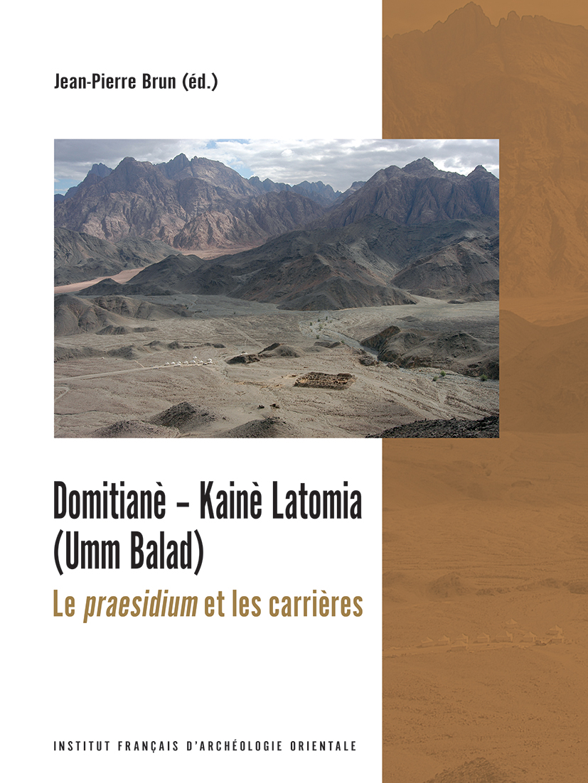
Domitianè - Kainè Latomia (Umm Balad)
Le praesidium et les carrières
Les fouilles (ministère des Affaires étrangères/Ifao) menées à Domitianè/Kainè Latomia (Umm Balad) en 2001‑2003 viennent préciser nos connaissances sur l’occupation du désert Oriental d’Égypte à l’époque romaine. Ce site, implanté dans le massif du Porphyritès, possède un gisement de « granito verde fiorito di bigio » (diorite), dont la tentative d’exploitation a entraîné, sous Domitien, la construction par l’armée d’un petit fortin qui a servi de base de vie aux ouvriers des carrières. Quoique très mutilée, l’inscription de la porte indique une date de construction vers 88-92. Ce premier état ne semble pas pouvoir aller au-delà du début du règne de Trajan. Le praesidium fut sans doute abandonné par la suite, jusque vers 146. Il ne fut réoccupé alors que pour une brève période de temps, avant d'être de nouveau abandonné.
L’examen des deux carrières apporte quantité d’enseignements quant à l’organisation des travaux d’exploitation mais les scénarios que nous pouvons établir sur leur histoire respective restent en grande partie spéculatifs. La mise en service de Kainè Latomia se solda finalement par un échec, dû probablement à une mauvaise qualité de la pierre. Toutefois quelques blocs furent envoyés à Rome où ils furent d’abord employés pour la décoration de la domus Flavia sur le Palatin.
The excavations carried out at Domitianè/Kainè Latomia (Umm Balad) in 2001‑2003 by the French Ministry of Foreign Affairs/IFAO have added to our knowledge of the occupation of the Eastern Desert of Egypt in Roman times. This site, located in the Porphyrites massif, has a rock deposit of "granito verde fiorito di bigio" (gray flowered green granite). The attempt to exploit it led to the construction of a small fort by the army under Domitian. It served as a base for the quarry workers. The gate inscription, although very mutilated, indicates a date of construction around 88–92. This early phase does not seem to go beyond the beginning of Trajan’s reign. The praesidium was probably abandoned thereafter, until around 146, when it was reoccupied for only a short period of time, before being abandoned again.
The examination of the two quarries provides a lot of information about the organization of the work, but what can be established about their respective histories remains speculative for the most part. The use of Kainè Latomia finally ended in failure, probably due to the poor quality of the stone. However, some blocks were sent to Rome where they were used first of all for the decoration of the Domus Flavia (Flavian Palace) on the Palatine.
إنّ حفائر (وزارة الخارجيَّة الفرنسيَّة / المعهد الفرنسيّ للآثار الشَّرقيَّة) التي أُجريت في دوميتيان/ كايني لاتوميا (أُمّ بلد) في الفترة من ٢٠٠١م إلى ٢٠٠٣م قد أضافت إلى معرفتنا عن التواجد في صحراء مصر الشَّرقيَّة في العصر الرّوماني. يحتوي هذا الموقع، الواقع في كُتلةٍ صخريَّة من البورفيريت، على رواسب صخريَّة من «جرانيتو فيردي فيوريتو دي بيجيو» [الجرانيت الأخضر المُزهّر باللون الرمادي] (ديوريت)، والتي أدّت مُحاولة استغلالِها في عهد دوميتيان إلى بناء الجيش لحصن صغير كسكن لعُمّال المحاجر. وعلى الرغم من تشوّهِها الشّديد، إلّا أنَّ نقش البوابة يُشير إلى تاريخ البناء الذي يرجع إلى الفترة من ٨٨ إلى ٩٢م تقريبًا. يبدو أنَّ هذه الحالة المُبكِّرة لم تتجاوز بداية عهد الإمبراطوار تراچان. رُبَما قد تمَّ ترك الفرقة بعد ذلك، حتّى حوالي عام ١٤٦م، عندما أُعيدَ استخدامها لفترةٍ قصيرة فقط، قبل أنْ يتمَّ تركها مرَّةً أُخرى.
يوفّر فحص المحجرين الكثيرَ مِنَ المعلوماتِ حول تنظيم أعمال الاستغلال، لكن الإحتمالات التي يُمكِنُنا وضعها حول تاريخ كُلّ منهما تظل تخمينيّة إلى حدٍّ كبير. انتهى تشغيل محجر كايني لاتوميا أخيرًا بالفشل، رُبَّما بسبب رداءة الحجر. ومع ذلك، تمَّ إرسال بعضَ الكُتَلِ إلى روما حيث تمَّ استخدامها لأوَّل مرّة لتزيين «دوموس فلافيا» في پالاتين.
- Jean-Pierre Brun ( : 02929245X)
Jean Pierre Brun a été ingénieur d’études au ministère de la Culture (service régional de l’Archéologie, PACA) et il a dirigé le Centre archéologique du Var, avant de devenir chercheur au CNRS (1983). Directeur du Centre Jean Bérard à Naples de 2000 à 2011, il est devenu professeur au Collège de France en 2011 (chaire « Techniques et économies de la Méditerranée antique »). Titulaire d’une thèse d’État soutenue en 1999, il s’est spécialisé dans l’histoire du vin et de l’huile dans l’Antiquité, ainsi que dans celle de l’artisanat. Il a ainsi dirigé en Provence, puis en Grèce et en Italie du sud de nombreuses fouilles consacrées à ces questions. Depuis 1994, il a régulièrement collaboré à la mission française (ministère des Affaires étrangères/Ifao) du désert Oriental d’Égypte, dirigée par Hélène Cuvigny (CNRS). Jean Pierre Brun a reçu en 2004 la médaille d’argent du CNRS.
- Vous pouvez acquérir ce(s) fichier(s) PDF issu(s) de cet ouvrage en cliquant sur le nom du fichier puis 'Ajouter au panier'.
- You can buy theses PDF files extracted from this book by clicking on the file name then 'Add to cart'.
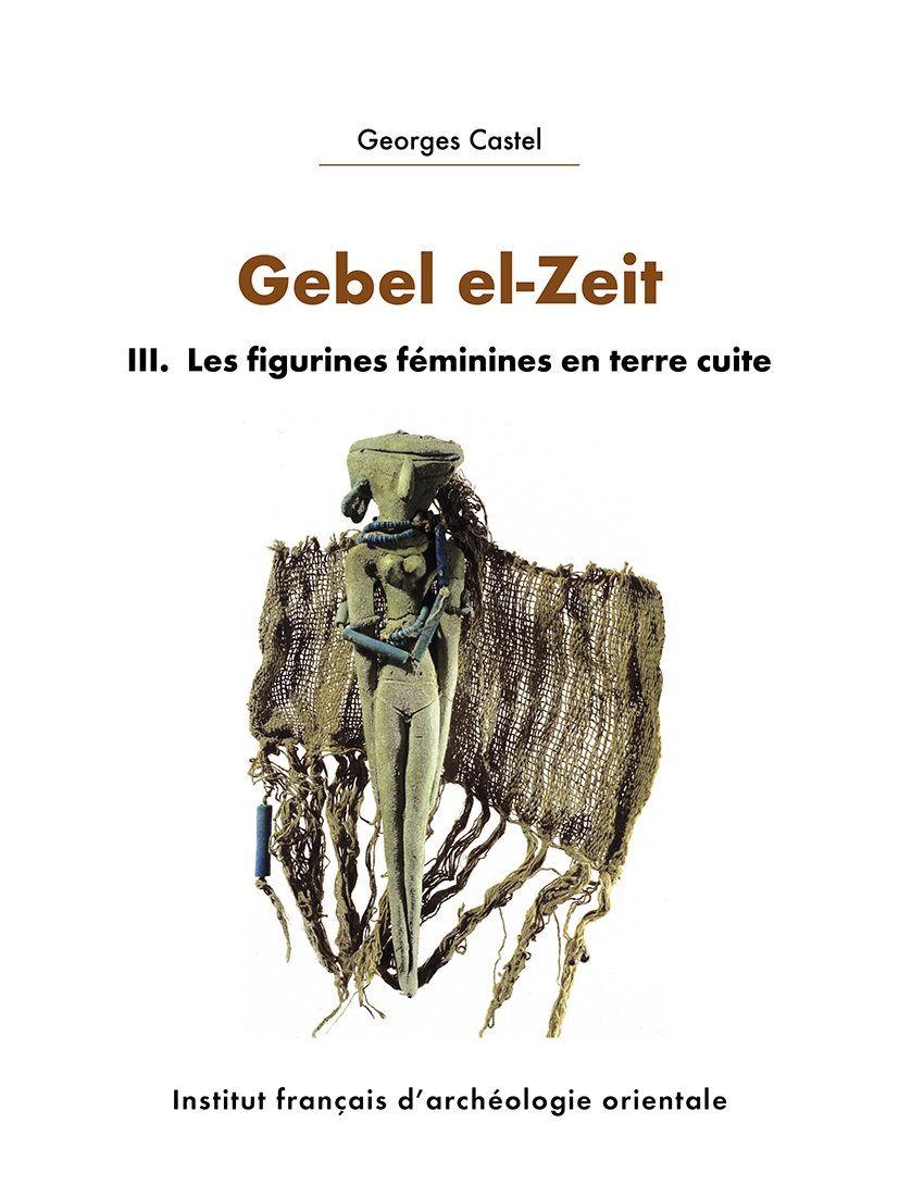
Georges Castel
Gebel el-Zeit III
Les figurines féminines en terre cuite
Au IIe millénaire av. J.-C., des expéditions pharaoniques traversent le désert oriental égyptien afin d’aller extraire la galène du Gebel el-Zeit au bord de la mer Rouge. Attenant aux mines, un sanctuaire d’Hathor « maîtresse de la galène » consiste en un enclos de pierres sèches adossé au rocher. Il comportait un abondant matériel déposé en ex-voto, datable de la XIIe dynastie au règne de Ramsès II, notamment des figurines féminines en terre cuite enveloppées de riches étoffes et parées de bijoux. La présente publication est une présentation de ces figurines et de leurs transformations durant cette longue période.
In the 2nd millennium BC, pharaonic expeditions crossed the Egyptian eastern desert to extract galena from Gebel el-Zeit on the shores of the Red Sea. Adjacent to the mines, a sanctuary of Hathor "mistress of galena" consisted of a dry-stone enclosure set against the rock wall. It contained a wealth of material deposited as ex-voto offerings, dating from the 12th Dynasty to the reign of Ramses II, in particular female terracotta figurines wrapped in linen and adorned with jewels. This publication presents these figurines and their transformations over this long period.
في الألفية الثّانية قبل الميلاد، عبرت البعثات المصريّة القديمة الصَّحراءَ الشَّرقيَّة المِصْريَّة لاستخراج الجالينا من جبل الزَّيت على شواطئ البحر الأحمر. بجوار المناجم، وجدت مقصورة لحتحور «سيدة الجالينا»، تتكوّن من سور من الحجر الجاف مستند على الصخر. وقد احتوت على ثروة من المواد المودعة كقرابين، ولا سيما تماثيل طينيّة لسيّدات ملفوفة بالكتان الثمين ومُزيّنة بالجواهر، يعود تاريخها إلى عصر الأسرة الثانية عشرة وحتّى عهد الملك رمسيس الثاني. يتناول هذا الكتاب دراسة لتلك التماثيل الصَّغيرة، وتحوّلاتها، خلال تلك الفترة الزَّمنيَّة الطّويلة.
- Georges Castel ( : 026771314)
Architecte de fouilles et archéologue à l’IFAO, Georges Castel a dirigé ou codirigé de nombreux programmes de fouilles en Égypte, dont la mission d’Ayn Soukhna de 2001 à 2016.
- Vous pouvez acquérir ce(s) fichier(s) PDF issu(s) de cet ouvrage en cliquant sur le nom du fichier puis 'Ajouter au panier'.
- You can buy theses PDF files extracted from this book by clicking on the file name then 'Add to cart'.
ISBN 9782724709926
2024 IFAO
Collection: FIFAO 93
Langue(s): français
2 vol. 536 p.
123 € (6474 EGP)
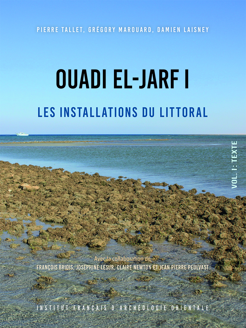
Pierre Tallet, Grégory Marouard, Damien Laisney
Ouadi el-Jarf I
Les installations du littoral
Le port pharaonique du Ouadi el-Jarf est constitué d’un ensemble d’installations (galeries magasins, campements, installations maritimes) qui se répartissent sur une distance d’environ 5 km, entre le piémont du Gebel Galala el-Qibliya et la côte du golfe de Suez. Ce premier volume, résultat de fouilles menées entre 2012 et 2021, a pour objectif de présenter les aménagements qui se trouvent sur le littoral de la mer Rouge où l’on observe encore les vestiges d’une jetée de grande taille en forme de « L » destinée à fournir un abri aux embarcations qui fréquentaient le port, ainsi que ceux d’une série de campements installés à quelque 200 m du littoral. Cette zone était particulièrement fréquentée par les équipes d’ouvriers qui étaient chargées du montage et du démontage des bateaux utilisés sur le site. Le riche matériel recueilli lors de la fouille de cette zone du site comprend notamment de nombreuses empreintes de sceaux aux noms des rois Snéfrou et Chéops — qui permettent de dater l’occupation du site du tout début de la IVe dynastie — ainsi qu’un dépôt exceptionnel d’une centaine d’ancres de bateaux qui avaient été abritées dans ces bâtiments au terme de la dernière grande expédition maritime organisée à cet endroit. Celles-ci sont régulièrement inscrites au nom des embarcations auxquelles elles appartenaient, et nous renvoient une image de la dernière flotte qui a fréquenté les lieux vers 2600 av. J.-C.
The pharaonic port of Wadi el-Jarf is composed of a set of settlements (storage caves, camps, maritime installations) that are spread over a distance of 5 km, from the foothills of the Gebel el-Galala el-Qibliya to the coast of the Gulf of Suez. This first volume presents the results of the excavations conducted in the coastal part of the site between 2012 and 2021. There, one can still see the remains of a large L-shaped pier, built to provide a shelter for the boats that frequented the harbor, as well as camps— some 200 m from the seashore—that were surely the dwelling places of the workers in charge of the on-site assembling and dismantling of the boats used for expeditions (stored in the caves). The abundant material collected during the excavations includes numerous seal impressions on clay showing the names of Snefru and Khufu, dating the occupation of the site to the two first kings of the 4th Dynasty, and an exceptional deposit in one of the camps of one hundred stone boat anchors, many of them still inscribed with the names of the boats to which they belonged. This gives us a glimpse of the last fleet that made use of the harbor c. 2600 BC.
ميناء «وادي الجرف» المصري القديم عبارة عن مجموعة من المنشآت (ممرات للتخزين، معسكرات، مُنشآت بحريَّة) تنتشر على مسافة ٥ كم، ما بين سفوح «جبل الجلالة» القبليَّة وحتّى ساحل خليج السّويس. يهدف هذا المُجلّد الأوَّل - الذي يقدم نتائج الحفائر التي تمَّت في هذا الجزء من الموقع بين عامي ٢٠١٢ و٢٠٢١م - إلى عرض التطورات على ساحل البحر الأحمر حيث لا يزال في الإمكان رؤية بقايا رصيف كبير على شكل حرف L، تمَّ بناؤه لتوفير مأوى للمراكب التي كانت تتردّد على الميناء، فضلًا عن المعسكرات – التي تبعد حوالي ٢٠٠ متر عن شاطئ البحر – والتي كان يشغلها العمال المسؤولون عن تجميع وتفكيك القوارب المستخدمة في الموقع. وتشتمل المواد الوفيرة التي تمَّ جمعها أثناء التنقيب على عِدَّة أختام على الطين تُظْهِر اسمي سنفرو وخوفو، مما يسمح لنا بتأريخ فترة إشغال الموقع في بداية الأسرة الرّابعة؛ كما تشتمل على مستودع استثنائي للمئات من مراسي المراكب التي وضعت في هذه المباني بعد آخر حملة بحرية كبيرة نُظمت في هذا المكان، لا يزال العديد منها منقوشًا عليها اسم المراكب التي كانت تنتمي إليها. وهذه تعكس لنا صورة الأسطول الأخير الذي قدم إلى هذا المكان في حوالي عام ٢٦٠٠ قبل الميلاد.
- Pierre Tallet ( : 07926817X)
Ancien élève de l’École normale supérieure (Ulm), agrégé d’histoire et ancien adjoint aux publications de l’Ifao, Pierre Tallet est actuellement titulaire de la chaire d’égyptologie de la Sorbonne et directeur de l’Ifao. Depuis 2001, dans le cadre d’un programme consacré aux expéditions minières égyptiennes en mer Rouge, il a dirigé ou co-dirigé les missions archéologiques d’Ayn Soukhna et du ouadi el-Jarf – deux ports pharaoniques récemment identifiés sur la côte du golfe de Suez – et mené une prospection au sud de la péninsule du Sinaï. - Grégory Marouard ( : 15990322X)
Gregory Marouard est un archéologue spécialisé dans l’étude des vestiges de l’Égypte ancienne, à toutes les périodes de son histoire, du prédynastique à l’époque gréco-romaine. Il a participé à de nombreuses fouilles (entre autres à Tebtynis, Bouto, Edfou, Ayn Soukhna et au Ouadi el-Jarf). Il enseigne actuellement l’archéologie égyptienne à l’université de Yale. - Damien Laisney ( : 122830687)
Damien Laisney, topographe, a été membre de l’Institut français d’archéologie de 1996 à 2010. Il a dans ce cadre participé à la plupart des missions archéologiques de l’Ifao, aussi bien dans la Vallée du Nil que dans les déserts arabique et libyque et le Sinaï. Il est rattaché à la Maison de l’Orient et de la Méditerranée de Lyon (CNRS FR 3747).
- Vous pouvez acquérir ce(s) fichier(s) PDF issu(s) de cet ouvrage en cliquant sur le nom du fichier puis 'Ajouter au panier'.
- You can buy theses PDF files extracted from this book by clicking on the file name then 'Add to cart'.
ISBN 9782724708493
2023 IFAO
Collection: FIFAO 91
Langue(s): français
2 vol. 615 p.
69 € (3632 EGP)
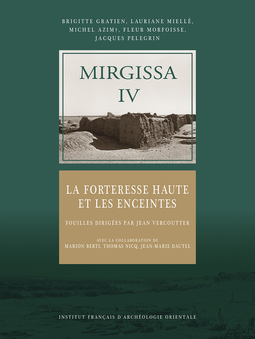
Brigitte Gratien, Lauriane Miellé, Michel Azim, Jacques Pelegrin, Fleur Morfoisse
Mirgissa IV
La forteresse haute et les enceintes
Construite au sud des rapides de la deuxième cataracte, la forteresse haute de Mirgissa/Iqen protège ce site de la frontière méridionale de l’Égypte et contrôle les voies fluviales et terrestres ; liée aux enceintes qui entourent les habitats de la plaine, les ateliers et les installations portuaires, elle fut probablement édifiée sous le règne de Sésostris Ier, comme Bouhen plus au nord. C’est un modèle d’architecture militaire du Moyen Empire avec sa double enceinte fortifiée, les fossés, les glacis ; elle abrite aussi la résidence du gouverneur, l’armurerie, des bâtiments affectés aux grandes institutions égyptiennes, des sanctuaires, des ateliers, ainsi que différents habitats.
Quatre niveaux principaux ont été reconnus. La première enceinte fut très vite remplacée sous la XIIe dynastie par un établissement complexe dont le plan intérieur ne varia guère ; on y accédait via une porte monumentale. À la fin du Moyen Empire, les habitats se diversifient, avec la construction de résidences de tailles diverses. Pendant le Nouvel Empire, le site perd sa fonction première et les bâtiments sont divisés ou reconstruits.
Le mobilier mis au jour est varié, dont une remarquable collection d’armes lithiques du Moyen Empire ; les centaines de céramiques ont permis l’établissement d’une typologie.
Built south of the rapids of the Second Cataract, the Upper Fortress of Mirgissa/Iqen protected this site on Egypt’s southern frontier and controlled river and desert roads. It was linked to the enclosure walls surrounding the settlements, the workshops and the harbour in the lower parts of the site. It was probably built under the reign of Senwosret I, as was the fortress Buhen further north. It is a good example of Middle Kingdom’s military architecture with its double fortified enclosure, ditches and glacis. It also houses the governor’s residence, the armory, buildings assigned to major Egyptian institutions, sanctuaries, workshops, and various habitats.
Four main levels have been discovered. During the twelfth dynasty, the first enclosure wall was replaced by a large fort whose interior map did not vary much; it was accessed through a monumental gate. At the end of the Middle Kingdom, the settlements diversified, with the construction of residences of various sizes. During the New Kingdom, the site lost its primary function and the buildings were divided or rebuilt.
The furniture unearthed is varied, including a remarkable collection of lithic weapons from the Middle Kingdom; the hundreds of ceramics have made it possible to establish a new typology.
- Brigitte Gratien ( : 026901196)
Directeur de recherche émérite CNRS (UMR 8164, HALMA-IPEL, Université de Lille 3) et directeur de la Mission Archéologique Française de Gism el-Arba (chantiers de Gism el-Arba, Zankor, Abou Sofyan), Brigitte Gratien a participé aux fouilles de Mirgissa et de Saï, sous la direction du Pr. J. Vercoutter, spécialiste des cultures nubiennes et de leurs relations avec l'Egypte pharaonique. - Lauriane Miellé ( : 172765315)
Lauriane Miellé, céramologue, a soutenu une thèse de doctorat à l'université de Lille en 2013 sur la céramique du Nouvel Empire découverte au Soudan actuel. Elle a participé à plusieurs missions sur l'Ile de Saï. Elle est en charge des études sur la céramique pharaonique pour les sites de Mirgissa et de Gism el-Arba (Soudan). - Michel Azim ( : 056920903)
Ingénieur de recherche au CNRS et membre de la SFE de longue date, Michel Azim avait participé à de nombreuses missions au Soudan et au Liban de 1967 à 1974, avant de diriger, durant onze ans, la section chargée de l'architecture, de la topographie et des fouilles au Centre franco-égyptien d'étude des temples de Karnak (CFEETK). - Jacques Pelegrin ( : 034765360)
Préhistorien spécialiste de technologie lithique, Jacques Pelegrin s'intéresse aux techniques de taille des outils préhistoriques et protohistoriques, y compris en regard de leur place dans le développement des capacités cognitives au cours de l'hominisation. - Fleur Morfoisse ( : 181381281)
Fleur Morfoisse est conservatrice en chef des antiquités et des arts décoratifs au Palais des Beaux-Arts de Lille depuis 2009.
- Vous pouvez acquérir ce(s) fichier(s) PDF issu(s) de cet ouvrage en cliquant sur le nom du fichier puis 'Ajouter au panier'.
- You can buy theses PDF files extracted from this book by clicking on the file name then 'Add to cart'.
ISBN 9782724708073
2023 IFAO
Collection: FIFAO 90
Langue(s): français
1 vol. 616 p.
95 € (5000 EGP)
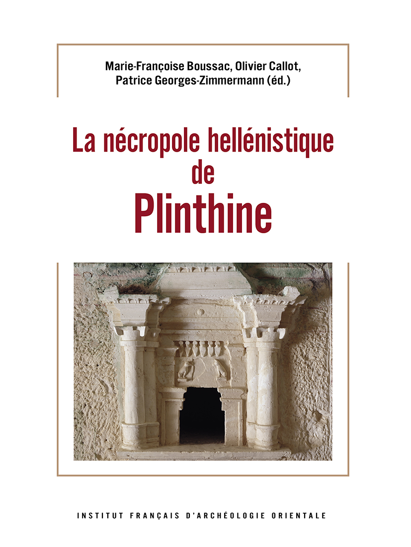
Marie-Françoise Boussac (éd.), Olivier Callot (éd.), Patrice Georges-Zimmermann (éd.)
La nécropole hellénistique de Plinthine
La nécropole hellénistique de Plinthine, située à environ 800 m à l’ouest de l’établissement urbain de Kôm el Nogous/Plinthine, aux marges occidentales de la chôra alexandrine, a été aménagée sur et dans la ride de calcarénite ou ténia qui sépare la Méditerranée du lac Mariout. Elle a été célébrée depuis les premières fouilles par Achille Adriani en 1937, suivies de diverses interventions non publiées, comme une version miniature des grandes nécropoles alexandrines, mais elle n’avait pas fait l’objet d’une étude globale alliant analyse architecturale et enquête sur les pratiques funéraires. La politique suivie par la mission (MFTMP) – relevé architectural systématique d’une nécropole trop souvent analysée à travers le prisme de quelques hypogées, accent mis sur le phasage, études anthropologiques – a permis de donner une vision plus globale de la nécropole de Plinthine que celle fournie par les études antérieures : les morts ne sont plus absents et la nécropole retrouve une histoire parallèle à celle de la bourgade hellénistique de Plinthine.
The Hellenistic necropolis of Plinthine, located about 800 m west of the urban settlement of Kom el Nogus/Plinthine, on the western margins of the Alexandrian chora, was built on and in the calcarenite ridge or taenia that separates the Mediterranean from Lake Mariut. It has been celebrated as a miniature version of the great Alexandrian necropolises since the first excavations by Achille Adriani in 1937, followed by various unpublished explorations. Nevertheless, it had not been the subject of a comprehensive study combining architectural analysis and investigation of funerary practices.
The policy followed by the French expedition (MFTMP)—systematic architectural survey of a necropolis too often previously analyzed through the prism of a few hypogeas, emphasis on phasing, anthropological studies—made it possible to give a more global vision of the Plinthine necropolis than that provided by earlier studies: the dead are no longer absent and the necropolis reveals a history parallel to that of the Plinthine Hellenistic town.
- Marie-Françoise Boussac ( : 031837123)
Marie-Françoise Boussac est historienne, ancien membre de l'École française d'Athènes et professeur émérite d'histoire grecque à l'université de Paris Nanterre. Spécialiste de l'Orient hellénisé et de l'Égypte gréco-romaine, elle a travaillé sur les archives et les sceaux du monde hellénistique, sur les échanges entre la Méditerranée et l'océan Indien et a été PI pour un programme collaboratif sur les bains (Balneorient : voir https://balneorient.hypotheses.org). Elle a été directrice de la mission française à Taposiris et Plinthine, qu'elle a lancée, de 1998 à 2017. Elle est responsable de la rédaction de la revue Topoi depuis 1991. - Olivier Callot ( : 032346972)
Directeur de recherche honoraire au CNRS (HISOMA, Maison de l’Orient), architecte DPLG, spécialiste d'architecture antique, archéologue, numismate, a travaillé à Chypre, au Proche-Orient (Syrie, Liban, Jordanie) et dans le golfe (Koweit). En Égypte il a participé au chantier de la nécropole de Gabbari et a fait l’étude architecturale de la nécropole de Plinthine. - Patrice Georges-Zimmermann ( : 192461214)
Patrice Georges-Zimmermann, Ingénieur chargé de recherches à l’Inrap, est archéo-anthropologue et coéquipier de la Cellule d’intervention sur les structures archéologiques profondes (Cisap). Il est membre de l’UMR 5608 TRACES (Université Toulouse Jean-Jaurès) et participe notamment aux recherches du Pôle Afrique. Son travail porte sur la mise en évidence des pratiques funéraires et des gestes portés sur et autour du corps, dans des contextes chrono-culturels différents, concernant aussi bien la France que l’Afrique. Il a travaillé sur de nombreux chantiers dont, en Égypte, ceux des nécropoles alexandrines (Gabbari notamment) et de Plinthine ; il participe aujourd’hui au nouveau programme du site de Bouto/Tell el Fara.
- Vous pouvez acquérir ce(s) fichier(s) PDF issu(s) de cet ouvrage en cliquant sur le nom du fichier puis 'Ajouter au panier'.
- You can buy theses PDF files extracted from this book by clicking on the file name then 'Add to cart'.
ISBN 9782724707977
2022 IFAO
Collection: FIFAO 89
Langue(s): français
2 vol. 304 p.
82 € (4316 EGP)
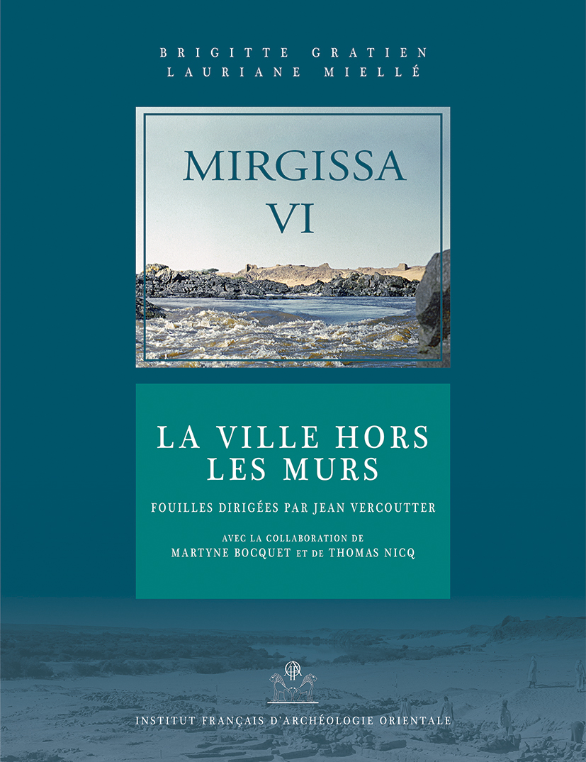
Brigitte Gratien, Lauriane Miellé
Mirgissa VI
La ville hors les murs
Le volume VI de la série Mirgissa est consacré à la publication de la ville civile égyptienne MI, une des implantations les plus anciennes sur le site. Située au nord de la forteresse à laquelle elle était reliée par l’une des premières enceintes, elle fermait la zone portuaire du mnnw Iqen. Elle fut probablement construite sous Sésostris Ier, comme Bouhen à l’autre extrémité des rapides de la deuxième cataracte. Cet habitat, proche du Nil, a la forme d’un vaste quadrilatère ; il est protégé par sa propre enceinte de pierres. Le plan diffère des « villages d’ouvriers ». À l’ombre des ruelles s’entremêlent de vastes demeures patriciennes – édifiées en briques crues à l’abri de leur enceinte sinusoïdale, avec leurs installations domestiques et parfois leur propre jardinet –, et des maisons plus modestes édifiées en pierres, ou encore des ateliers de potiers, des boulangeries. Un grand jardin ou potager occupe le centre du village. Le mobilier, presque uniquement de la céramique, date l’occupation de la deuxième moitié de la XIIe dynastie à la fin du Moyen Empire. Cette édition comporte un volume de texte et un coffret présentant trente-sept plans du site.
The sixth volume of the Mirgissa series is devoted to the publication of the Egyptian civil town MI, one of the most ancient settlements. Located north of the fortress, it was linked to it by one of the earliest enclosure walls, surrounding the harbor of Iqen’s mnnw. It was probably built during the reign of Senusret I, like Buhen at the other end of the second cataract. This settlement, near the Nile, has the form of a large rectangle protected by its own stone enclosure wall. The plan differs from that of a “workers’ settlement”. The elite dwellings along the narrow streets are built in mud brick within sinusoidal walls, with domestic installations and sometimes with their own small gardens. Smaller houses are built with stones, as well as bakeries and potters’ workshops. A large garden or kitchen-garden is in the middle of the settlement. Finds within the settlement, most only pottery, date the occupation between the second half of the XIIth dynasty and the end of the Middle Kingdom. This edition includes a volume of text and a folder with thirty-seven plans of the site.
- Brigitte Gratien ( : 026901196)
Directeur de recherche émérite CNRS (UMR 8164, HALMA-IPEL, Université de Lille 3) et directeur de la Mission Archéologique Française de Gism el-Arba (chantiers de Gism el-Arba, Zankor, Abou Sofyan), Brigitte Gratien a participé aux fouilles de Mirgissa et de Saï, sous la direction du Pr. J. Vercoutter, spécialiste des cultures nubiennes et de leurs relations avec l'Egypte pharaonique. - Lauriane Miellé ( : 172765315)
Lauriane Miellé, céramologue, a soutenu une thèse de doctorat à l'université de Lille en 2013 sur la céramique du Nouvel Empire découverte au Soudan actuel. Elle a participé à plusieurs missions sur l'Ile de Saï. Elle est en charge des études sur la céramique pharaonique pour les sites de Mirgissa et de Gism el-Arba (Soudan).
- Vous pouvez acquérir ce(s) fichier(s) PDF issu(s) de cet ouvrage en cliquant sur le nom du fichier puis 'Ajouter au panier'.
- You can buy theses PDF files extracted from this book by clicking on the file name then 'Add to cart'.