Douch
| Noms anciens | Kesh (égyptien), Kysis (grec) |
| 10.34816/ifao.b1d2-2c9d | |
| 031414419 | |
| Missions Ifao depuis | 1976 |
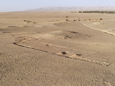
The ML1 epipalaeolithic site. Camp-site for hunter-gatherers during the 7th millennium near an artesian spring.
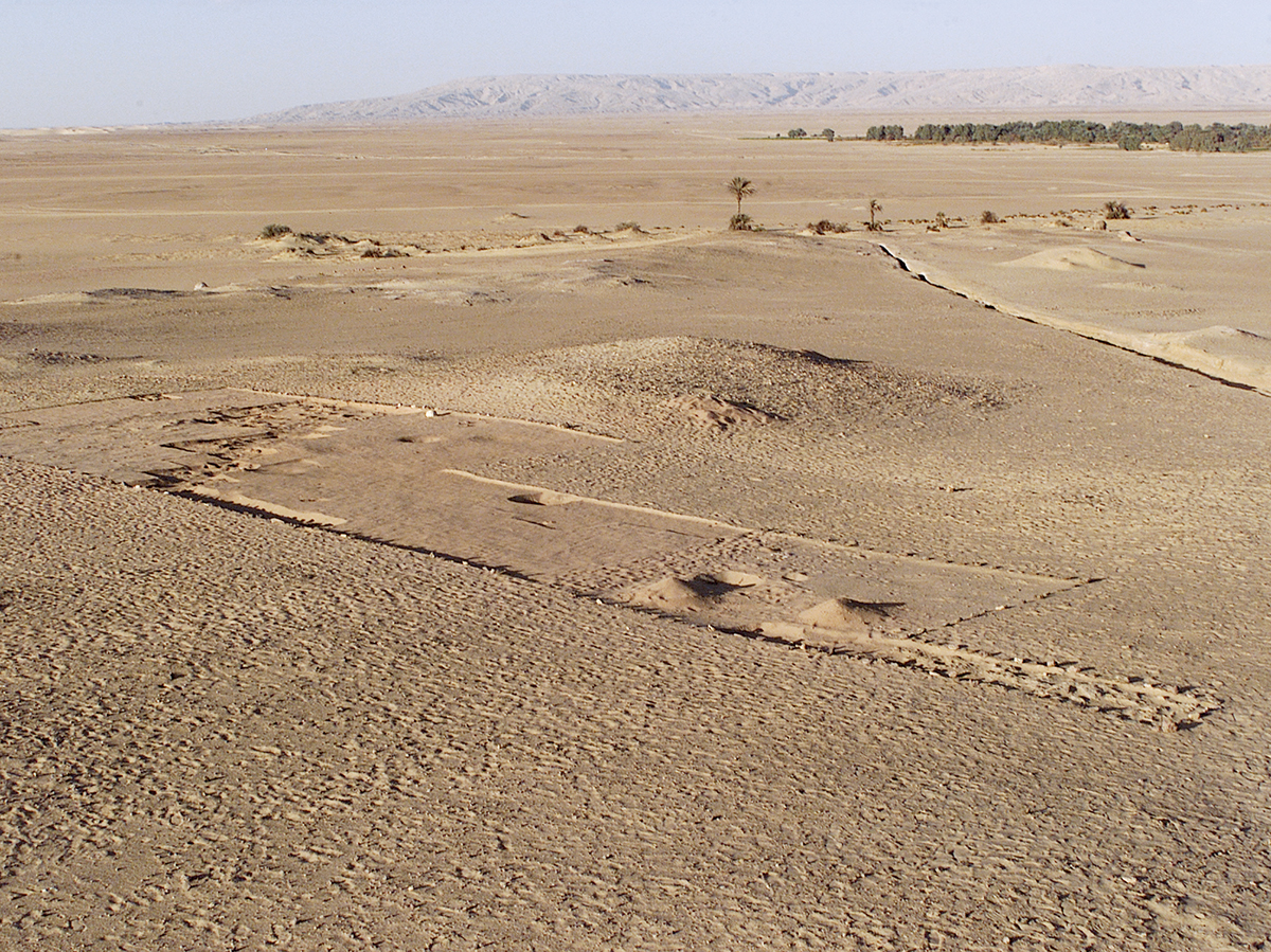
The Neolithic occupation of KS43 (5th millennium) under excavation.
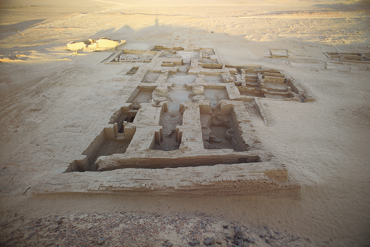
The temple of Osiris-iu at Ain Manawir.
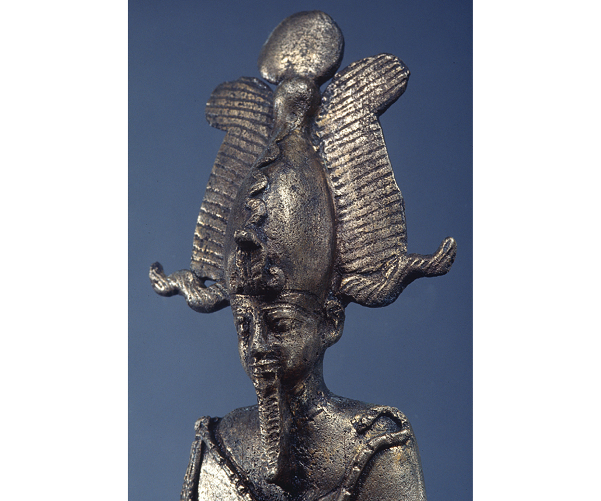
Close-up of a bronze figure of Osiris discovered in the temple of Osiris-iu at Ain Manawir.
© Ifao/J.-F. Gout.
À partir de 1994, l’intérêt s’est porté vers la communauté agricole voisine d’époque perse, Ayn Manâwir, dont l’existence relève de la mise en pratique d’une technique hydraulique nouvelle, les qanâts. Dès le début des années 1980 et jusqu’en 1992, l’aménagement du milieu naturel par les populations antiques avait fait l’objet d’études approfondies associant les données géomorphologiques à l’analyse des techniques mises en œuvre pour l’indispensable maîtrise de l’eau. Cette démarche impliquait une vision plus large du territoire et de la chronologie. C’est dans cette perspective que, dans les années 2000, a débuté sous la direction de Michel Wuttmann, un programme de prospections destiné à dresser la carte archéologique du bassin sud de l’oasis. Les travaux sur la Préhistoire prirent place dans ce cadre. Ils s’inscrivent sur la trajectoire de ceux initiés par Gertrude Caton-Thompson au début du XXe siècle.
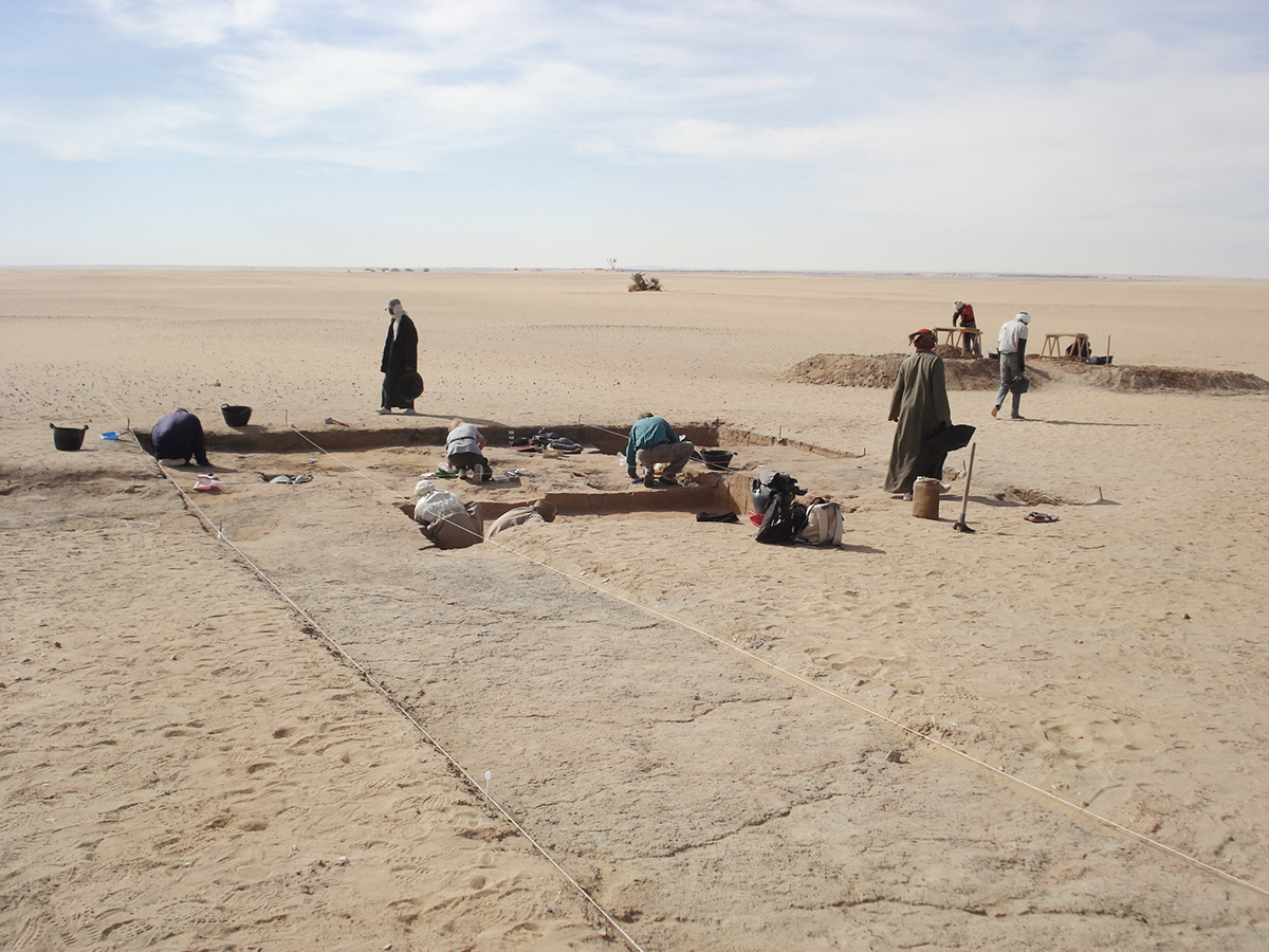
Quatre-vingt quatre sites relevant de la Préhistoire récente (Holocène) ont été testés par des sondages ou ont fait l’objet de véritables campagnes de fouille.
Dans ces espaces écologiquement fragiles, liés aux changements climatiques drastiques qui ont conduit à l’aridification du Sahara vers 4500 av. J.-C., les travaux ont permis de suivre de quelle manière les communautés humaines ont adapté leurs stratégies d’accès à l’eau. Deux sites majeurs l’illustrent. ML1 témoigne du passage de chasseurs-cueilleurs épipaléolithiques du VIIe millénaire se regroupant autour de puits artésiens, pourvoyeurs d’eau en abondance. Les sites KS43-KS52 renseignent la phase néolithique, quand les hommes devenus pasteurs parcouraient la région en quête de points d’eau en raréfaction. Ces travaux ont donné lieu à une thèse de doctorat soutenue par Tiphaine Dachy qui permet à présent d’établir, pour ce secteur de l’oasis, les jalons d’une périodisation des installations humaines reposant sur la caractérisation des assemblages archéologiques et un programme de datation radiocarbone.
En 1993, à quelques kilomètres de Douch, sur le site d’Ayn Manâwir, l’Ifao a mis au jour un temple en briques crues formant le cœur d’une agglomération qui s’est développée entre le Ve et le IVe s. av. J.-C. Les vestiges du site ont livré un matériel extrêmement riche dans ce temple dédié à la forme osirienne locale, l’Osiris-iou : ostraca démotiques, statuettes en bronze, mobilier céramique, vestiges de la décoration du temple, objets rituels, etc. Les ostraca ont fourni un éclairage exceptionnel sur la vie de la communauté à cette époque, ainsi que des données chronologiques sur une période assez mal documentée. Quant aux statuettes en bronze, elles constituent un ensemble unique par le contexte dans lequel elles ont été découvertes, celui d’une salle du temple, et non, comme souvent, celui d’une cachette secondaire.
C’est aussi à l’Osiris-iou qu’est dédié le temple en pierre qui fut construit à l’époque romaine à Douch. Le temple a fait l’objet d’études épigraphique et architecturale, tandis que les nécropoles voisines d’époque romaine ont également été fouillées.
Michel Wuttmann (†), Béatrix Midant-Reynes (CNRS, UMR 5608) et Laurent Coulon (Ifao/EPHE-PSL)
From 1994, attention lay on Ain Manawir, the neighbouring rural community dating to the Persian period, where excavations exposed the way in which a new hydraulic technique, the qanats, had operated. From the beginning of the 1980s until 1992, detailed studies have focussed on how ancient populations managed the natural environment, relating geomorphological data to the analysis of techniques adopted for the essential control of water. This approach required a wider understanding of the landscape and its chronological development. It was with this perspective, during the 2000s, that a programme of surveys was begun under the direction of Michel Wuttmann with the aim of producing an archaeological map of the oasis’ southern depression. Work on prehistoric remains took place within this framework. It carried forward the approach initiated by Gertrude Caton-Thompson at the beginning of the 20th century.
Soundings were conducted at eighty-four sites relating to recent prehistoric times (the Holocene) with the aim of undertaking archaeological excavations. In these ecologically fragile areas, linked to the dramatic climatic changes which led to the desertification of the Sahara about 4500 BC, the work has enabled us to track how human communities adapted strategies to access water. Two sites in particular illustrate this. ML1 testifies to the movement of hunter-gatherers during the Epipalaeolithic (dating the 7th millennium) who clustered around artesian wells which provided them with water in abundance. The sites KS43-KS52 belong to the Neolithic period, when man became farmers while spreading around the region in search of sources of clean water. The doctoral thesis resulting from this research, which was undertaken by Tiphanie Dachy, has enabled us to establish, based on the characterisation of archaeological assemblages and a radiocarbon dating programme, the chronological milestones for this region of the oasis during this period of human settlement.
In 1993, some kilometres from Dush, at the site of Ain Manawir, the IFAO exposed a mud-brick temple at the heart of a settlement which developed between the 5th and 4th centuries BC. The site’s remains revealed extremely rich material within this temple dedicated to the local form of Osiris, Osiris-iu, which included demotic ostraca, bronze statuettes, ceramic items, remains of the temple’s decoration, ritual objects etc. The ostraca have been exceptionally illuminating about the community’s life at this period, as well as providing chronological data about a period which is quite poorly documented. As for the bronze statuettes, they form a unique assemblage for the context in which they were discovered, that of a room in the temple, and not, as so often happens, in a secondary hoard.
It is also to Osiris-iu that the stone temple built in Dush during the Roman period was dedicated. This temple has been the subject of epigraphic and architectural study, while the neighbouring Roman period necropolises have also been excavated.
Michel Wuttmann (†), Béatrix Midant-Reynes (CNRS, UMR 5608) and Laurent Coulon (IFAO/EPHE-PSL)
بدءاً من عام 1994، اتجه الاهتمام إلى المجتمع الزراعيّ المجاور والذي يعود إلى العصر الفارسيّ في عين المناور التي ظهرت كنتيجة لتطبيق تقنيَّة مائيَّة جديدة، ألا وهي القنوات. ومنذ بداية الثمانينيَّات وحتى عام 1992، مَثَّلت تهيئة السكان القدماء للبيئة الطبيعية، موضوعَ دراساتٍ مُتعمِّقة تجمع بين المعطيات الـﭼيومورفولوﭼيَّة والتحليلات التِّقنِيَّة المُطبَّقة من أجل التحكم اللازم في المياه. وهذا الإجراء كان يستلزم رؤيةً أوسع للأرض والزمان؛ لذا، اعتبارًا من عام 2000 تحت إدارة ميشيل ڤوتمان، تم البدء في برنامج استكشافيّ، يهدف إلى رسم خريطةٍ أثريَّةٍ للحوض الجنوبيّ للواحة. كما أن الأعمال التي تناولت عصور ما قبل التاريخ اتَّخذت مكانًا لها في هذا الإطار، وهي تتبعُ نفس مسار الأعمال التي بدأتها جيرترود كاتون-تومسون في بداية القرن العشرين.
هناك 84 موقعًا يعودون إلى عصور ما قبل التاريخ (العصر الهولوسيني) حيث تم اختبارهم من خلال المجسَّات أو خضعوا لبعثات تنقيب حقيقية. وفي هذه الأماكن الهَشَّة بيئيًّا والمرتبطة بالتغيُّرات المُناخيَّة الحادة التي أدت إلى قحولة الصحراء منذ عام 4500 ق. م. تقريبًا، سمحت تلك الأعمال بتتبُّع كيفية تطويع المجتمعات الإنسانية لاستراتـيچيَّتها للوصول للمياه. هناك موقعان يُدلِّلان على هذه المسألة: أولهما الموقع ML1 الذي يشهد على مرور صيادين-جامعي ثمار من العصر الإبيباليوليتي من الألفيَّة السابعة، والذين تجمَّعوا حول العيون الارتوازيَّة حيث تتدفَّق المياه بغزارة. والمواقع KS43-KS52 التي تغطي حقبة العصر الحجريّ الحديث، عندما تحول الرجال إلى رُعَاة يقطعون المنطقة بحثًا عن أماكن المياه التي كادت أن تكون نادرة. هذه الأعمال كانت موضوع أُطْروحَة دكتوراه لتيفاني داشي، وتسمح حاليًّا بوضع علامات «لتحقيب» المنشآت الإنسانيَّة المرتكزة على توصيف التجميعات الأثريَّة وبرنامج تأريخ بالكربون المُشعّ لهذا القطاع من الواحة.
في عام 1993، وعلى بعد عدة كيلومترات من دوش، في موقع عين المناور، كشف المعهد الفرنسيّ للآثار عن معبدٍ من الطوب اللَّبِن، في قلب تَجمُّعٍ نما بين القرنين الخامس والرابع ق. م.؛ وكذلك كشفت شواهد عن مواد شديدة الثراء في هذا المعبد المُخصَّص للشكل المحليّ لآلهة الديانة الأوزيرية أوزيريس-إيو ومن بينها أُوستراكا ديموطيقيَّة، وتماثيل صغيرة من البُرُنْز، وأثاث من الخَزَفْ، وبقايا من زخارف المعبد، وقطع طقسيَّة، إلخ. ألقت الشَّقْفَات (الأوستراكا) ضوءًا استثنائيًّا على حياة المجتمعات في هذا العصر؛ وكذلك على معطيات زمنيَّة عن حقبة غير موثَّقة بشكلٍ جيدٍ إلى حدٍّ كبير. أما تماثيل البُرُنْز الصغيرة، فهي تمثل مجموعة مُتفرِّدة بالنسبة للسياق الذي اكتُشفت فيه، حيث عُثِر عليها في قاعة المعبد وليس في خبيئة ثانويَّة، كما هي العادة.
ومعبد دوش، المَبْنيّ من الحجر، مكرس لأوزيريس-إيو، وقد بُنيَ في دوش في العصر الرومانيّ. وكان المعبد موضوع دراسات إبيجرافيَّة ومعماريَّة، كما جرى التنقيب في الجبَّانات المجاورة كذلك.
ميشيل ڤوتمان (†)، بياتريكس ميدان-رين (المركز الوطنيَ للبحث العلميِ - UMR 5608)،ولوران كولون (المعهد الفرنسيّ للآثار الشرقيَّة - المدرسة التطبيقيَّة للدراسات العليا - شبكة الجامعات الباريسيَّة للعلوم والآداب)
Bibliographie
- H. Barakat, N. Baum, Douch. II. La végétation antique. Une approche macrobotanique, DFIFAO 27, Le Caire, 1992.
- B. Bousquet, Tell Douch et sa région : géographie d’une limite de milieu à une frontière d’Empire, DFIFAO 31, Le Caire, 1996.
- M. Wuttmann, T. Gonon, C. Thiers, « The Qanats of ‘Ayn Manawîr, Kharga Oasis Egypt », Journal of Achaemenid Studies and Researches 1, 2000, en ligne, http://www.achemenet.com/ressources/enligne/jasr/.
- M. Reddé, Douch. III. Kysis. Fouilles de l’Ifao à Douch, Oasis de Kharga (1985-1990), DFIFAO 42, Le Caire, 2004.
- F. Briois, B. Midant-Reynes, M. Wuttmann, Le gisement épipaléolithique de ML1 à ‘Ayn Manawîr : oasis de Kharga, FIFAO 58, Le Caire, 2008.
- M. Chauveau, « Les archives démotiques du temple de Ayn Manâwir », ARTA 2011.002, 2011, p. 1-19, en ligne, http://www.achemenet.com/document/2011.002-Chauveau.pdf.
- F. Briois, B. Midant-Reynes, M. De Dapper, J. Lesur-Gebremariam, S. Marchand, C. Newton, Y. Tristant, M. Wuttmann, « The occupation of an artesian spring area at the beginning of the late Holocene major arid phase in the Kharga Oasis », Journal of Field Archaeology 37/3, 2012 , p. 178-191.
- F. Laroche-Traunecker, Le sanctuaire osirien de Douch, FIFAO, Le Caire, sous presse.
- Page web Douch archivée (2012)