Catalogue des publications
pays/zone estimés: 192.168.253.1 EGY XXX- Pour effectuer une commande, remplissez votre panier puis terminez votre commande. Vous pourrez effectuer un paiement sécurisé et être livré dans le monde entier. J’ai un code promotionnel
- To perform an order, fill your cart then proceed the order. You will be driven to a secured page for the electronic payment which includes worldwide shipping fees. I have a promotional code.
Fouilles de l’Institut français d’archéologie orientale (FIFAO)
La collection Fouilles de l’Institut français d’archéologie orientale (FIFAO) se consacre à la publication scientifique des travaux archéologiques conduits sur l’ensemble des chantiers de l’Ifao. Elle est constituée de plusieurs séries : Balat, Tebtynis, Karnak-nord, Archéologie islamique, etc.
ISBN 9782724707502
2020 IFAO
Collection: FIFAO 83
Langue(s): français
1 vol. 468 p.
75 € (3750 EGP)
Bérangère Redon (éd.), Thomas Faucher (éd.)
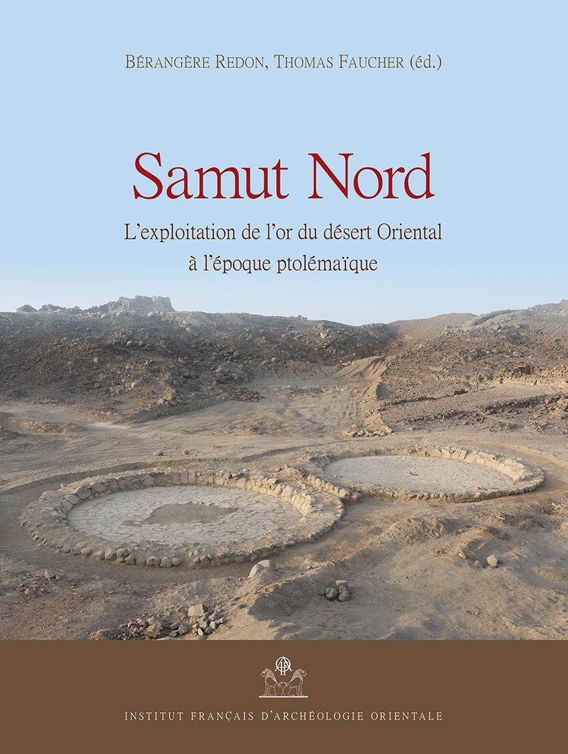
Samut Nord
L'exploitation de l'or du désert Oriental à l'époque ptolémaïque
Situé dans le désert Oriental égyptien, Samut Nord est un site entièrement voué à l’exploitation de l’or. Constitué de zones d’extraction et de transformation du quartz aurifère et de deux édifices dédiés au logement, il est occupé brièvement vers 310 av. J.-C. Avant leur destruction en 2017, les vestiges de Samut Nord étaient exceptionnellement bien préservés et leur exploration représentait l’opportunité d’étudier, pour la première fois et dans son intégralité, une installation minière à l’apogée de l’exploitation de l’or en Égypte. C’était aussi l’occasion de comparer le témoignage des vestiges archéologiques aux descriptions des mines antiques laissées par Agatharchide de Cnide, qui vécut au IIe siècle av. J.-C. La confrontation des données permet de dresser un panorama inédit de la chaîne opératoire qui a produit une partie de l’or dont Ptolémée, fils de Lagos, avait besoin pour conduire sa politique en Méditerranée. L’étude attentive de tous les vestiges, y compris les plus modestes, permet aussi de reconstituer les conditions de vie des habitants (soldats, intendants, mineurs, dont peut-être des femmes) qui ont, durant quelques saisons, vécu au milieu du désert pour en exploiter les richesses. Elles étaient manifestement effroyables. Est adjointe à ces chapitres l’étude de trois villages de mineurs localisés dans le district de Samut, occupés au Nouvel Empire et à l’époque médiévale.
Located in the Eastern desert of Egypt, Samut North is a site entirely devoted to gold mining. Consisting of areas for the extraction and transformation of gold quartz and two vast buildings dedicated to housing, it was briefly occupied around 310 BC. Before they were destroyed in 2017, the remains of Samut North were exceptionally well preserved and their exploration represented a unique opportunity to fully study a mining facility at the height of gold mining in Egypt. It was also a chance to compare the evidence of the archaeological remains with the descriptions of the ancient mines left by Agatharchides of Cnidus, who lived in the 2nd century BC. The comparison of the data makes it possible to draw up an unprecedented panorama of the operating chain that produced part of the gold that Ptolemy, son of Lagos, needed to conduct his policy in the Mediterranean. The careful study of all the remains, including the most modest ones, also makes it possible to reconstruct the living conditions of the inhabitants (soldiers, logisticians, miners, including perhaps women) who, for some seasons, lived in the middle of the desert to exploit its riches. They were obviously appalling. Added to these chapters is a study of three mining villages in Samut district dating back to the New Kingdom and the Middle Ages.
- Bérangère Redon (
 : 140353542)
Ancienne membre scientifique de l’IFAO de 2009 à 2012, Bérangère Redon est chargée de recherche au CNRS (HiSoMA, Lyon) depuis 2012. Historienne et archéologue, elle s’appuie sur l’étude combinée des vestiges et des textes pour mener une étude à la fois historique, culturelle, économique et sociale de la présence grecque et romaine en Égypte. Elle développe des travaux sur l’appropriation (pratique, symbolique, économique) des espaces égyptiens, en particulier des marges et des frontières, par les différents pouvoirs qui se sont succédé sur le trône égyptien de l’époque saïte à l’époque romaine et sur les rencontres culturelles entre les populations établies sur le sol égyptien. Pour nourrir ces travaux, Bérangère Redon travaille depuis 2010 au sein de la mission archéologique française du désert Oriental (IFAO, MEAE), dont elle a assuré la direction de 2013 à 2017. En parallèle, elle participe depuis 2002 à la mission française de Taposiris-Plinthine (IFAO, MEAE), sur la côte méditerranéenne. Elle en a repri - Thomas Faucher ( : 116523085)
Archéologue et numismate, il est chargé de recherche à l'IRAMAT-CRP2A (CNRS/Université Bordeaux Montaigne). Centrées sur l’histoire économique et monétaire, ses recherches traitent en particulier de la production et de la circulation de la monnaie en Égypte ancienne, ainsi que des méthodes d'extraction des minerais ayant servi à leur fabrication. Membre de la mission française du désert Oriental depuis 2011, il la dirige depuis 2018.
- Vous pouvez acquérir ce(s) fichier(s) PDF issu(s) de cet ouvrage en cliquant sur le nom du fichier puis 'Ajouter au panier'.
- You can buy theses PDF files extracted from this book by clicking on the file name then 'Add to cart'.
ISBN 9782724707359
2019 IFAO
Collection: FIFAO 81
Langue(s): français
1 vol. 304 p.
45 € (2250 EGP)
Adam Bülow-Jacobsen, Jean-Luc Fournet, Bérangère Redon
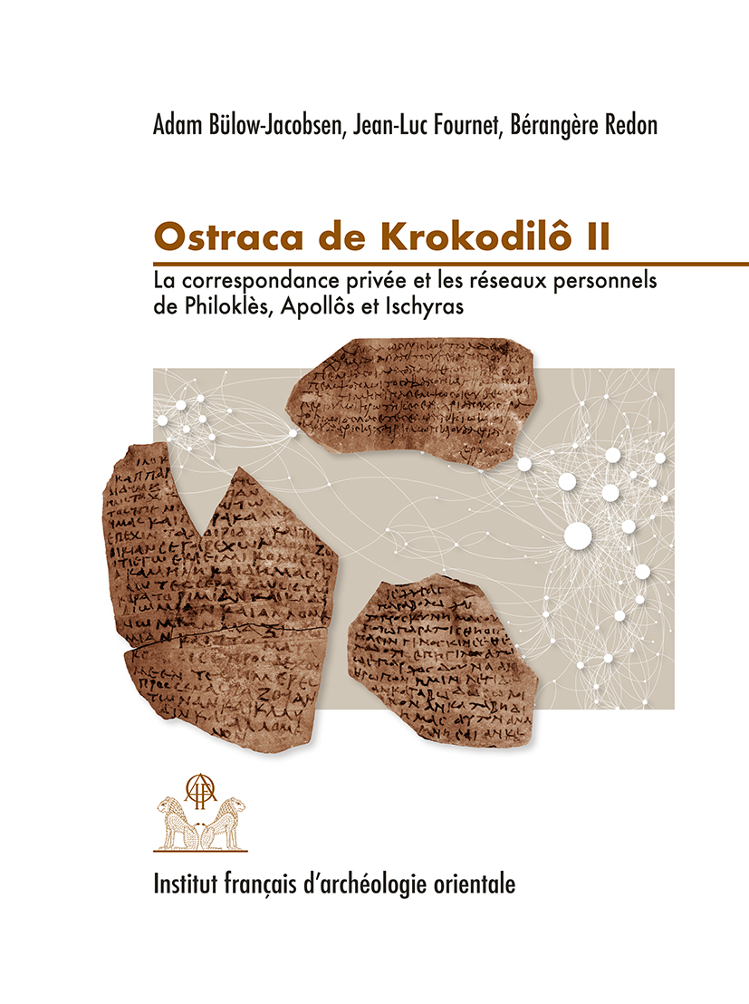
Ostraca de Krokodilô II
La correspondance privée et les réseaux personnels de Philoklès, Apollôs et Ischyras. Praesidia du désert de Bérénice V. O.Krok. 152-334.
Le fort de Krokodilô, fouillé en 1996 et 1997 par la Mission française du désert Oriental, est situé sur la route reliant Coptos, dans la Vallée du Nil, à Myos Hormos, sur la mer Rouge. Son dépotoir, formé sous les règnes de Trajan et Hadrien, a livré plus de 800 ostraca, dont 189 sont publiés dans ce volume. Après un premier volume des Ostraca de Krokodilô consacré à la correspondance militaire, le présent ouvrage s’intéresse à la correspondance privée que s’échangeaient les habitants de Krokodilô et des forts voisins, Phoinikôn et Persou. Les lettres ont été rédigées par trois personnalités très différentes : Philoklès, le vivandier et proxénète, joue un rôle central dans l’approvisionnement des habitants des fortins du désert, et dans le commerce de prostituées, dont il s’est fait une spécialité ; Ischyras, le carrier, est une connaissance de Philoklès, ses lettres regorgent de manifestations d’amitié tout en livrant quelques confidences peu amènes, indices de rapports humains parfois brutaux ; Apollôs enfin, en plus d’être semble-t-il un soldat, assure le rôle de scribe au sein d’un groupe dont les préoccupations concernent presque uniquement le ravitaillement. La richesse de ce corpus permet de reconstituer la vie des petites sociétés peuplant les garnisons du désert au début du iie s. apr. J.-C., et de mettre en lumière la vigueur des réseaux qui liaient les quelque 200 personnages qui apparaissent dans les ostraca. On y découvre l’importance des liens de solidarité dans un milieu hostile et la place essentielle des civils, notamment des femmes, dans la vie des fortins.
The fort of Krokodilo on the road from Coptos to Myos Hormos was excavated in 1996-97 by the French mission in the Eastern desert. Its rubbish-dump was formed during the reigns of Trajan and Hadrian, and produced over 800 ostraca, 189 of which are published in this volume. While the first volume of Ostraca de Krokodilô concerns military correspondence, this second volume contains private letters exchanged between the inhabitants of Krokodilo and the neighbouring forts, Phoinikon and Persou. The letters were written by three very different characters: Philokles, a green-grocer and pimp, plays a central role in supplying vegetables to the inhabitants of the desert forts and also organises the prostitution; Ischyras, a quarry-man, is an acquaintance of Philokles and his letters are full of declarations of friendship, but also contain some harsh remarks which demonstrate the brutality of certain human relationships; Apollos is probably a soldier, but also functions as a letter-writer for a group of people who are mostly concerned with their provisions of food. This rich corpus gives us a glimpse of the daily life in a society of some 200 people who lived in the desert garrisons at the beginning of the 2nd century AD, and who appear in the ostraca. We are able to witness the importance of solidarity in this hostile environment and the important role of civilians, not least the women, in the life around the forts.
- Adam Bülow-Jacobsen ( : 026650835)
PhD (Londin),ancien professeur de papyrologie à l’université de Copenhague, bénévole de l’Institut de papyrologie de la Sorbonne. Participant à de nombreuses fouilles de carrières et praesidia dans le désert oriental d’Égypte. - Jean-Luc Fournet ( : 066974054)
Ancien membre scientifique de l'IFAO (1992-1996) avant d'entrer au CNRS comme chargé de recherche, puis à l’École Pratique des Hautes Études comme directeur d’études en papyrologie grecque (Section des sciences historiques et philologiques). Il a été élu professeur au Collège de France sur la chaire « Culture écrite de l’Antiquité tardive et papyrologie byzantine » en 2015. Depuis 2017, il est aussi directeur d’études cumulant à l’École Pratique des Hautes Études. Éditeur de papyrus, il est aussi spécialiste de la culture écrite de l’époque protobyzantine. - Bérangère Redon ( : 140353542)
Ancienne membre scientifique de l’IFAO de 2009 à 2012, Bérangère Redon est chargée de recherche au CNRS (HiSoMA, Lyon) depuis 2012. Historienne et archéologue, elle s’appuie sur l’étude combinée des vestiges et des textes pour mener une étude à la fois historique, culturelle, économique et sociale de la présence grecque et romaine en Égypte. Elle développe des travaux sur l’appropriation (pratique, symbolique, économique) des espaces égyptiens, en particulier des marges et des frontières, par les différents pouvoirs qui se sont succédé sur le trône égyptien de l’époque saïte à l’époque romaine et sur les rencontres culturelles entre les populations établies sur le sol égyptien. Pour nourrir ces travaux, Bérangère Redon travaille depuis 2010 au sein de la mission archéologique française du désert Oriental (IFAO, MEAE), dont elle a assuré la direction de 2013 à 2017. En parallèle, elle participe depuis 2002 à la mission française de Taposiris-Plinthine (IFAO, MEAE), sur la côte méditerranéenne. Elle en a repri
ISBN 9782724707335
2019 IFAO
Collection: FIFAO 80
Langue(s): français
1 vol. 520 p.
69 € (3450 EGP)
Brigitte Gratien
Mirgissa V
Les empreintes de sceaux. Aperçu sur l'administration de la Basse Nubie au Moyen Empire
Le volume V de la série Mirgissa est consacré à la publication des empreintes de sceaux mises au jour sur ce site de la frontière méridionale de l’Égypte, et datées, pour la plupart, des XIIe et XIIIe dynasties. Plus de 15 000 fragments ont été recueillis dans la forteresse et sa décharge. Outre un grand nombre sur les huisseries des portes, et d’autres sur papyrus, les sceaux étaient appliqués sur des coffres et divers contenants. Les empreintes ont été laissées par des sceaux aux motifs géométriques ou gravés de signes hiéroglyphiques ; d’autres livrent les noms de rois et des représentations locales de grandes institutions comme le Trésor, les greniers, les magasins, le service du travail, ou encore donnent les titres et les noms de fonctionnaires. Certaines émanent de forts voisins.
Cet ensemble remarquable et unique a permis d’étudier, dans une seconde partie, l’organisation, au Moyen Empire, d’un mnnw, Mirgissa/Iqen, placé sous l’autorité d’un gouverneur, et ses relations avec la métropole et les autres citadelles de Nubie.
The fifth volume of the Mirgissa series is devoted to the publication of the seals, dating from the 12th and 13th dynasties, which were discovered in the Mirgissa fortress on the southern Egyptian frontier. More than 15,000 pieces were found. A number of the seals were on doorframes; others were on papyrus documents, boxes and containers. Some were inscribed with geometric patterns, hieroglyphs and names. These included the names of kings, local departments of the main Egyptian institutions (such as the treasury, the granaries, the wdja-stores and the department of labor); and even the titles and names of officials. Some of the seals had been sent from neighboring fortresses.
This remarkable collection has enabled us to study the organisation of a mnnw, Mirgissa/Iqen, during the Middle Kingdom, as well as its links with other Nubian fortresses or the Theban region.
- Brigitte Gratien ( : 026901196)
Directeur de recherche émérite CNRS (UMR 8164, HALMA-IPEL, Université de Lille 3) et directeur de la Mission Archéologique Française de Gism el-Arba (chantiers de Gism el-Arba, Zankor, Abou Sofyan), Brigitte Gratien a participé aux fouilles de Mirgissa et de Saï, sous la direction du Pr. J. Vercoutter, spécialiste des cultures nubiennes et de leurs relations avec l'Egypte pharaonique.
ISBN 9782724706949
2018 IFAO
Collection: FIFAO 78
Langue(s): français
1 vol. 264 p.
45 € (2250 EGP)
Claudio Gallazzi
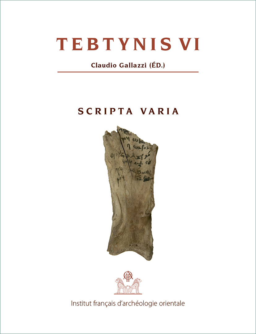
Tebtynis VI
Scripta Varia. Textes hiéroglyphiques, hiératiques, démotiques, araméens, grecs et coptes sur différents supports
L’abondant matériel découvert à Tebtynis comporte peu de textes en hiéroglyphes et en araméen, d’ostraca hiératiques, ou encore de graffiti, d’inscriptions, de timbres, scellés, os et morceaux de verre inscrits. Pour autant, ces inscriptions ne sont pas dépourvues d’intérêt et le présent volume répond au souci de les rassembler, en les classant selon la langue, le type d’écriture et le support utilisé. Des indices complètent la répartition réalisée. Grâce à cette présentation, le lecteur qui s’intéresse à un type particulier de textes les trouvera tous réunis au même endroit, et quiconque étudie Tebtynis pourra aisément récupérer les renseignements que ces pièces offrent sur le village. Afin de faciliter les études sur Tebtynis et éviter la dispersion des travaux concernant l’agglomération, un appendice consacré aux papyrus du temple de Soknebtynis, l’un des legs majeurs du site à la science moderne, a été intégré au volume.
The abundant material discovered at Tebtynis includes few hieroglyphic or Aramaic texts, hieratic ostraca, graffiti, inscriptions, texts on stamps, seals, bones or glass. Nonetheless, these inscriptions are of interest and the present volume aims at gathering and classifying them, according to their language, the type of inscription and the material used. Indexes complete the classification. Thanks to this presentation, the reader interested in a particular type of text will easily find them grouped together here and anyone studying Tebtynis will have easy access to all the information these pieces offer about the village. In order to facilitate studies on Tebtynis and to avoid the scattering of works on the village, an appendix devoted to the papyri of Soknebtynis, one of the major legacies of the site to modern science, has been included in this volume.
- Claudio Gallazzi ( : 058472797)
Titulaire de la chaire de papyrologie à l'université de Milan, Claudio Gallazzi est directeur de la mission archéologique franco-italienne de Umm-el-Breigât (Tebtynis) depuis sa création en 1988.
ISBN 9782724707229
2018 IFAO
Collection: FIFAO 77
Langue(s): français
2 vol. 648 p.
89 € (4450 EGP)
Julie Monchamp
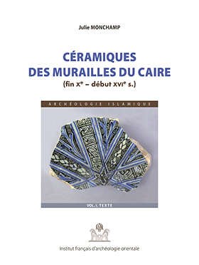
Céramiques des murailles du Caire (fin Xe - début XVIe siècle)
Les fouilles archéologiques entreprises par la fondation Aga Khan et l’Institut français d’archéologie orientale entre 2000 et 2009, le long de la muraille médiévale du Caire, ont révélé la présence d’un précédent rempart, bâti en briques crues, dont l’existence n’était jusqu’alors signalée que par les sources écrites. Outre le dégagement de cette enceinte, les fouilles ont permis d’exhumer des bâtiments funéraires fatimides, des structures artisanales ayyoubides, ainsi que des habitats et ateliers d’artisans mamelouks.
La mise au jour de ces vestiges s’accompagne de la découverte de nombreux fragments de céramiques des époques fatimide, ayyoubide et mamelouke, en partie datés par l’analyse stratigraphique des contextes archéologiques. L’étude du matériel présenté dans ce volume permet de retracer sur plus de cinq siècles l’évolution d’un répertoire morphologique jusqu’ici peu connu. Il en ressort une grande diversité de formes et de productions glaçurées, ainsi que des spécificités propres à chacune des trois périodes chronologiques. L’ étude apporte aussi un éclairage sur la vie quotidienne et sur le contexte socio-économique d’un quartier de la capitale aux époques considérées.
The archaeological excavations undertaken by Aga Khan Cultural Services and the French Institute of Oriental Archeology in Cairo between 2000 and 2009 along the Ayyubid walls of Cairo, revealed an earlier mud brick rampart which, until then, had only previously been spoken of in written sources. Moreover, these excavations revealed Fatimid tombs, Ayyubid artisan structures, as well as houses and workshops from the Mamluk era.
A large quantity of pottery sherds from the Fatimid, Ayyubid and Mamluk eras were also discovered and dated thanks to the stratigraphic analysis of the site. The study of the material presented in this volume shows the chronological development of the shapes of common and glazed wares over more than five centuries. It also reveals a great diversity of forms and glazing techniques as well as specific aspects of each of the periods presented. Lastly, it helps shed light on the daily life and socio-economic context of this district of the capital during the relevant periods.
- Julie Monchamp ( : 162036388)
Céramologue et docteur en archéologie islamique. Diplômée de l’université Paris IV-Sorbonne en 2011, Julie Monchamp a par la suite été membre scientifique de l’Ifao. Ses recherches portent sur le mobilier céramique médiéval en Égypte et au Proche-Orient.
ISBN 9782724707250
2018 IFAO
Collection: FIFAO 79
Langue(s): français
1 vol. 352 p.
49 € (2450 EGP)
Patrice Lenoble
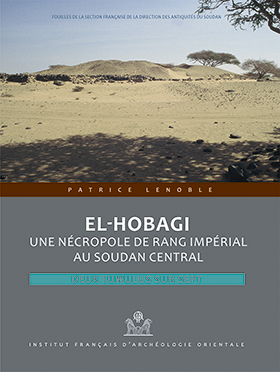
El-Hobagi : une nécropole de rang impérial au Soudan central
Deux tumulus sur sept
La Fin de Méroé est bien connue en Nubie, par les tombes royales de Qoustoul et Ballana, et par les fouilles de capitales à Faras et au Gebel Adda. Pour documenter la période dans la région de Méroé même, la Section française a sondé en 1987-1990 les monuments du site d’el-Hobagi. Des sept grands tumulus à sépultures souveraines, tous enclos d’un mur d’enceinte très original, deux ont été fouillés. Chaque tombe procure un armement exceptionnel, emblématique de la royauté méroïtique. On compte aussi une série étonnante de récipients en bronze gravés de motifs ou de scènes et ayant servi au culte. L’un d’eux porte l’inscription en hiéroglyphes la plus tardive de l’Empire (REM 1222). La datation du matériel et le radiocarbone situent el-Hobagi au ive siècle, au début, donc de l’époque charnière du transfert de la capitale vers Soba. Le cimetière d’el-Hobagi est postérieur au cimetière nord des qore de Méroé, et contemporain à la fois des dernières pyramides du cimetière ouest et des cimetières Garstang 400 et 500. Y est soulignée la persistance d’un État méroïtique dans le Soudan central, quand la Nubie fait sécession. L’interprétation ne permet pas d’affirmer qu’el-Hobagi succède à Méroé ; pour autant, par leurs rites funéraires, les personnages enterrés là – peut-être des ethnarques Noba comparables aux rois Nobades de Nubie – affirment leur appartenance à l’Empire méroïtique.
The End of Meroe is best known in Nubia from the royal tombs at Qustul and Ballana and by the excavations in the capitals at Faras and Gebel Adda. For documentation on the same period in the region of Meroe, the Section française surveyed in1987-1990, the monuments of the site at el-Hobagi. Of the seven large tumuli covering the graves of kings, all enclosed by a wall of unusual form, two were excavated. Each grave produced exceptional weaponry, insignia of Meroitic royalty. There was also an astonishing series of vessels in bronze engraved with motifs or scenes and used for ritual purposes. One of them bore an inscription in hieroglyphs, the latest known in the Empire (REM 1222). The dating of the material and that derived from radiocarbon analysis place el-Hobagi in the 4th century, at the beginning of the pivotal period of the transfer of the capital towards Soba. The cemetery of el-Hobagi is later than the North Cemetery of the rulers of Meroe, and contemporary with both the latest pyramids in the West Cemetery and of Garstang’s cemeteries 400 and 500. It emphasised the persistence of the Meroitic state in central Sudan, when Nubia was already lost. The interpretation does not allow an affirmation that el-Hobagi succeeded Meroe; but, by their funerary rites, the individuals interred – perhaps of Noba ethnicity comparable to the kings of Nobadia in Nubia – were asserting that they belonged to the Meroitic Empire.
- Patrice Lenoble ( : 161124895)
Archéologue qui a toujours voulu et su garder sa liberté de mouvement, Patrice Lenoble a partagé sa vie professionnelle entre le Soudan, le Liban et la DRAC des pays de Loire. Dans les années 1980, il a consacré la plus déterminante partie de sa carrière à répondre à la question de la Fin de Méroé, les fouilles d'El-Hobagi publiées ici sont le résultat de ce questionnement.
ISBN 9782724707021
2017 IFAO
Collection: FIFAO 76
Langue(s): anglais
1 vol. 144 p.
27 € (1350 EGP)
Éric Crubézy
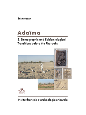
Adaïma III
Demographic and Epidemiological Transitions before the Pharaohs
The Adaïma necropolis in the Nile Valley of Egypt has revealed more than 800 morphologically well preserved skeletons (adults, new-borns and children) dated from 3800 to 3000 BC. This makes it one of the most important prehistoric human samples in such a good state of conservation.
It provides a unique opportunity to study the coevolution of man and diseases at this period. A synthesis of the study of funerary practices at this site takes into account the type of burial, whether these were primary or secondary burials, the occurrence of multiple burials, the existence of “human sacrifices” and differences in funerary practices between the different sectors of the cemetery.
We propose a methodology to study funerary practices based on the three stages: to view, hide and sanctify. A paleodemographic study can apportion the role of the selection of subjects to be buried and the demography of ancient populations. These studies are then combined with a systematic survey of lesions in adults and children, whether infectious diseases, traumatic injuries, growth disorders, osteoarthritis and enthesopathies, DISH, rheumatologic diseases (spondyloarthritis), oral pathology, non-specific lesions (cribra orbitalia, endocranial lesion, periostitis, Harris lines), and pathologies more difficult to study in the past such as dystocia childbirth, calcified lymph node and bladder stones. This allows us to derive the frequency of these diseases and lesions in the ecological context of the Nile Valley, and compare it with that of other prehistoric populations.
In Adaïma, the mortality rate was particularly related to an increase in the number of children per family, and a tuberculosis epidemic. The natural history of tuberculosis at this period resembles that in populations with no prior exposure to the disease during the historical period. A study on dental discrete traits shows that several populations of different origins lived in the Valley at this period. Adaïma derived from one of these heretofore unknown populations.
- Éric Crubézy ( : 035504579)
ISBN 9782724706932
2017 IFAO
Collection: FIFAO 75
Langue(s): français
1 vol. 448 p.
54 € (2700 EGP)
Roland-Pierre Gayraud, Lucy Vallauri
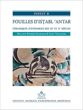
Fustat II. Fouilles d’Isṭabl ʿAntar
Céramiques d'ensembles des IXe et Xe siècles
Les fouilles d’Isṭabl ʿAntar se sont déroulées de 1985 à 2005 et ont mis au jour des vestiges sur une surface de plus de deux hectares. Elles ont livré une quantité considérable de matériels de toutes sortes, y compris de nombreux éléments organiques, dont la publication est en cours.
Les céramiques représentent une part majeure de ces trouvailles par leur nombre et leur qualité. Ce premier volume qui leur est consacré concerne des ensembles clos, le plus souvent des fosses, dont la chronologie s’échelonne du milieu du ixe siècle jusqu’à la fin du xe siècle.
Les apports de la fouille concernent à la fois la chronologie établie sur la stratigraphie, et de nombreux témoins numismatiques, ainsi qu’une typologie composant un catalogue presque complet des productions égyptiennes. Il s’agit ici de la naissance de la céramique islamique, au carrefour de traditions locales et d’apports extérieurs, quelquefois très lointains. Cette période charnière est riche en changements qui se décèlent aisément dans l’évolution des céramiques et des techniques qui leur sont propres.The excavations of Isṭabl ʿAntar were carried out between 1985 and 2005. They revealed remains on a surface of more than two hectares, and a large quantity of archaeological finds of various types, as well as organic material. The publication of this material is currently under progress.
Ceramics constitute the largest part of these finds, in quantity as well as quality. This first volume, which is devoted to ceramics, concerns closed groups of finds, mainly from pits. The chronology stretches from the middle of the 9th century to the end of the 10th century.
The contribution of these excavations concerns the chronology based on the stratigraphy and numerous numismatic finds, as well as a typology showing an almost complete catalogue of Egyptian productions. Here, we have testimonies to the birth of the Islamic ceramic, at the crossroads of local traditions and outside influences, some even coming from very far away. This turning point sees many changes in the evolution of ceramics and techniques.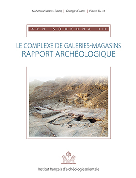
ISBN 9782724706925
2016 IFAO
Collection: FIFAO 74
Langue(s): français
1 vol. 368 p.
49 € (2450 EGP)
Mahmoud Abd el-Raziq, Georges Castel, Pierre Tallet
Ayn Soukhna III. Le complexe de galeries-magasins
Les complexes de galeries-magasins peuvent être considérés comme l’une des caractéristiques essentielles des « ports intermittents » de l’époque pharaonique qui ont été récemment identifiés. Ce type de dispositif a en effet été successivement mis en évidence sur les trois sites portuaires pharaoniques qui ont fonctionné sur la côte occidentale de la mer Rouge à Mersa Gaouasis, à Ayn Soukhna, et au ouadi el-Jarf. Ces galeries permettaient d’entreposer, entre deux expéditions, le matériel nautique qui leur était nécessaire, et en particulier des embarcations démontées qui étaient laissées sur place en attente de leur prochaine utilisation. La fouille de l’ensemble de ce complexe à Ayn Soukhna a permis de mieux comprendre la fonctionnalité des lieux, notamment grâce à la découverte en place, dans deux des magasins du site, de bateaux qui y avaient été soigneusement rangés avant d’être incendiés. Elle a également démontré la longue utilisation de ce port par les Égyptiens entre l’Ancien Empire et le Moyen Empire.
La fouille du site, fruit d’une collaboration entre l’Ifao, l’université d’Ismaïlia et l’université Paris-Sorbonne (UMR 8167 du CNRS), a entre autres été rendu possible par l’aide de plusieurs entreprises françaises installées en Égypte que nous remercions ici : Total-Égypte, Air Liquide, Métro du Caire ligne 3 (Bouygues, Vinci), Barrage d’Assiout (Vinci), Colas Rail, Gaz de France, Électricité de France, Saint-Gobain.Storage gallery complexes can now be considered a major characteristic of the pharaonic « periodic harbours » that have been successively identified on the sites of Mersa Gawasis, Ayn Soukhna and Wadi el-Jarf. In between two expeditions, those caves were used to store the sailing equipement, and especially dismanteled boats waiting for their next use. The systematic excavation of this whole Ayn Soukhna cave complex has allowed a better understanding of this site’s purpose thank to the discovery, in two of those galleries, of remains of boats that were carfully stored there before being destroyed by fire. It also shows the long use of the harbour by the Egyptians, between the Old Kingdom and the Middle Kingdom.
The archaeological work in Ayn Soukhna was led in the framework of a joint project of the IFAO, the Ismaïlia University and the Paris-Sorbonne University (CNRS UMR 8167). It was made possible, amongst other factors, by the help of several French companies that we want to thank here : Total Egypt, Air Liquide, Cairo Metro-Line 3 (Bouygues, Vinci), dam of Assiut (Vinci), Colas Rail, Gaz de France, Eletricité de France, Saint Gobain.- Mahmoud Abd el-Raziq ( : 092191029)
- Georges Castel ( : 026771314)
Architecte de fouilles et archéologue à l’IFAO, Georges Castel a dirigé ou codirigé de nombreux programmes de fouilles en Égypte, dont la mission d’Ayn Soukhna de 2001 à 2016. - Pierre Tallet ( : 07926817X)
Ancien élève de l’École normale supérieure (Ulm), agrégé d’histoire et ancien adjoint aux publications de l’IFAO, Pierre Tallet est actuellement titulaire de la chaire d’égyptologie de la Sorbonne. Depuis 2001, dans le cadre d’un programme consacré aux expéditions minières égyptiennes en mer Rouge, il a dirigé ou co-dirigé les missions archéologiques d’Ayn Soukhna et du ouadi el-Jarf – deux ports pharaoniques récemment identifiés sur la côte du golfe de Suez – et mené une prospection au sud de la péninsule du Sinaï.
ISBN 9782724706482
2014 IFAO
Collection: FIFAO 73
Langue(s): français
1 vol. 320 p.
49 € (2450 EGP)
Béatrix Midant-Reynes (éd.), Nathalie Buchez (éd.)
Tell-El-Iswid
2006-2009
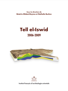
Découvert lors de prospections effectuées en 1987 par l’université d’Amsterdam, Tell el-Iswid s’est d’emblée présenté comme un site de première importance pour la connaissance du IVe millénaire dans le delta oriental du Nil. Tell el-Iswid fait partie d’un ensemble d’occupations humaines installées hors inondation, sur des gezira, qui témoignent des changements culturels majeurs ayant affecté cette partie septentrionale de l’Égypte à cette époque. L’un des principaux intérêts de Tell el-Iswid est de présenter une stratigraphie qui couvre la totalité du IVe millénaire. C’est vers cet objectif que se sont concentrés, de 2006 à 2009, les efforts de la mission française, dans le cadre de l’Institut français d’archéologie orientale, avec le soutien financier de la Commission des fouilles du ministère des Affaires étrangères. L’ouvrage présente l’ensemble des résultats obtenus de la réalisation d’une coupe transversale de 22 m de longueur sur 2 m de hauteur, qui a permis de préciser, de compléter et d’élargir la stratigraphie observée et décrite par l’équipe hollandaise quelque vingt ans auparavant. Les travaux effectués ont également permis d’appréhender les modes d’occupation de la gezira dans cette partie du tell, les traditions culturelles, qui connaissent des changements notoires, observables dans les structures domestiques – avec notamment l’apparition de l’architecture de briques crues –, dans les évolutions de la céramique et de l’industrie lithique. Les études conduites sur l’économie de subsistance, végétale et animale, montrent que de tels changements y sont également perceptibles.
Tell el-Iswid was discovered during the surveys made in 1987 by the University of Amsterdam, and was immediately recognised as an important site that provided information about the eastern Nile Delta in the 4th Millenium BCE Tell el-Iswid forms part of a set of human settlements located away from floods, on geziras, which bear witness to the major cultural changes that have affected the northern part of Egypt at the time. A significant component of Tell el-Iswid is the stratigraphy of the site, which spans the entire 4th millenium. It was this aspect that was the focus of the French mission between 2006 and 2009, which was undertaken within the Framework of the Institut français d’archéologie orientale and with the financial support of the Commision on Archaeological Excavations of the Foreign Affairs Ministry. This publication presents the results that were achieved by implementing a cross section 22 m in length and 2 m in height at the site. Using this technique the mission was able to clarify and expand the stratigraphy that was described by the Dutch team some twenty years ago. The cross section, as well as additional work at the site, has assisted in understanding the natural development and the land use of the gezira in this part of the tell. Development of cultural traditions can also be observed, such as notable changes in domestic features, including the appearance of mud-brick architecture, as well as changes in the ceramic and stone industries. Further studies conducted on the subsistence economy, including plants and animals, reveal additional changes.
- Béatrix Midant-Reynes ( : 030156963)
Béatrix Midant-Reynes s’est spécialisée dans l’étude de la préhistoire égyptienne. Elle a dirigé, dans le cadre de l’Ifao, plusieurs chantiers de fouilles en Égypte, tous centrés sur la période prédynastique : Adaïma, en Haute Égypte (nécropoles et habitat), Kom el-Khilgan, dans le Delta oriental (nécropole), Tell el-Iswid, dans le Delta oriental (habitat). En 2015, elle a transmis la direction de la fouille de ce site à Nathalie Buchez. De 2000 à 2015, elle a codirigé le volet préhistoire du programme de prospection du bassin sud de Douch (oasis de Kharga). De 2010 à 2015, elle a été directrice de l’Institut français d’archéologie orientale. Elle est actuellement directrice de recherche émérite au CNRS. Parmi les ouvrages publiés, deux sont adressés à un plus large public : Prehistory of Egypt, From the First Egyptians to the First Pharaohs, Londres, 2000, et Aux origines de l’Égypte. Du Néolithique à l’émergence de l’État, Paris, 2003. - Nathalie Buchez ( : 066514290)
Nathalie Buchez est responsable de recherche archéologique à l’Institut national de recherche en archéologie préventive (Inrap) où elle est plus particulièrement en charge d’opérations de terrain, d’études céramiques et de coordination de projets concernant les âges du Bronze et du premier âge du Fer dans le nord de la France. Docteure en archéologie de l’EHESS, rattachée à l’UMR 5608-TRACES de Toulouse, elle poursuit des recherches sur l’Egypte prédynastique depuis 1989. En 2015, elle a succédé à Béatrix Midant-Reynes comme responsable de la fouille de Tell el-Iswid (Delta oriental) pour l’Ifao et le ministère de l’Europe et des Affaires étrangères.